1
Society of African Missions, Lyonsdown, East Barnet
The large house on the left houses the Society of African Missions. The house is described as SMA House on the door plaque presumably because they did not want to be known as SAM House
Image: © Nigel Mykura
Taken: 22 Dec 2008
0.12 miles
2
SMA House Lyonsdown , East Barnet
This is the entrance door to the HQ of the Society of African Mission.
Image: © Nigel Mykura
Taken: 22 Dec 2008
0.12 miles
3
Weather Vanes, New Barnet
These weather vanes are on top of the old victorian house which is the headquarters building of the Society of African Missions in Lyonsdown Rd. It is unknown what the letter H stands for.
Image: © Nigel Mykura
Taken: 22 Dec 2008
0.12 miles
4
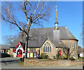
Holy Trinity Church, Lyonsdown, New Barnet
Image: © Ken Amphlett
Taken: 1 Feb 2014
0.14 miles
5
Holy Trinity Church, Lyonsdown Road
A Victorian parish church from 1866.
Image: © Des Blenkinsopp
Taken: 26 Feb 2019
0.15 miles
6
Station Road, Barnet (A110)
Station Road gridlocked by the snow.
Image: © Christine Matthews
Taken: 21 Dec 2009
0.16 miles
7
Mary Immaculate and St Peter's Church
Roman Catholic parish church on Somerset Road. It was built in 1938.
Image: © Des Blenkinsopp
Taken: 26 Feb 2019
0.16 miles
8
Bus stop on Lyonsdown Road, Barnet
Image: © David Howard
Taken: 2 Dec 2019
0.17 miles
9
Comer House, New Barnet
Hideously ostentatious development of apartments from 2003.
Image: © Jim Osley
Taken: 30 Jul 2014
0.17 miles
10
Station Road, New Barnet
DEL853 on the 84 approaches the junction with Warwick Road on route to St.Albans. This vehicle, an Alexander Dennis Enviro 200, has a dot matrix route display which the camera hasn't caught because of its refresh rate.
The 84 route was always an anomaly within the London Transport network, being a red route that went deep into the country bus area. Nowadays the 84 route is not a TFL route (ex London Transport), but is a commercial operation by Metroline, with support from Hertfordshire County Council and support from TFL over the Barnet to Potters Bar section. TfL Oyster cards can only be used on the Barnet-Potters Bar section. Transport for London don't normally allow dot-matrix displays, but as this is not a TfL route the buses are fitted with them. So the 84 continues its record for uniqueness.
A 307 to Brimsdown can be seen in the distance.
Image: © Martin Addison
Taken: 21 Nov 2008
0.17 miles


