1
Sir Thomas Foxwell Buxton in Brick Lane
The blue plaque marks the residence of the anti-slavery campaigner and MP who in 1823 formed the Society for the Extinction of the Slave Trade, aimed at total abolition. In 1824 he succeeded William Wilberforce as head of the anti-slavery party in parliament, continuing the struggle, until the Slavery Abolition Act in 1833 freed all enslaved people in the British Empire. Buxton Street runs east from here.
Image: © Natasha Ceridwen de Chroustchoff
Taken: 25 May 2008
0.01 miles
2
Blossom Street, Shoreditch
One of the atmospheric streets just east of Norton Folgate and Shoreditch High Street.
Image: © Stephen McKay
Taken: 16 Aug 2016
0.01 miles
3
Folgate Street, Spitalfields
18th century Huguenot weavers' houses line Folgate Street; they were saved from demolition by a concerted campaign in the 1960s. Overshadowing these are the ultra-modern Broadgate Tower and associated 201 Bishopsgate building. The 'A frame' structure of the tower is designed to provide structural strength; unlike conventionally-designed skyscrapers this building does not have a central core - necessary to distribute weight away from the raft across the railway out of Liverpool Street station on which it is built.
Image: © Stephen McKay
Taken: 19 Jun 2008
0.01 miles
4
View of Liverpool Street Station and the RBS Headquarters
Two for the price one here - on the left we have Liverpool Street station, and further down the road in the background we have the RBS headquarters. View taken looking west-northwest down Bishopsgate.
Image: © Robert Lamb
Taken: 7 Feb 2010
0.02 miles
5
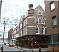
Spitalfields, The Water Poet
Pub at the corner of Blossom and Folgate Streets. Bar right, with eating and drinking areas front, left, right and in a side room; large patio, background music, sofas, horror film graphics. Cask ales on offer at my visit: Adnam Explorer, Basking Shark Truman's, Waggle Dance, Wells Bombardier. For some customer comments, see http://www.beerintheevening.com/pubs/s/17/17986/Water_Poet/Shoreditch
Image: © Mike Faherty
Taken: 21 Jul 2012
0.02 miles
6
Folgate Street
A cobbled street with three and four storey Victorian houses.
Image: © Martin Addison
Taken: 13 Feb 2009
0.02 miles
7
Norton Folgate - Looking Towards Bishopsgate
A pedestrian, dwarfed by the surrounding buildings, reads his newspaper as he walks. The City of London boundary marker on the right stands on the corner of the new 201 Bishopsgate building. Quite how the building gets a Bishopsgate address is a mystery as it is not on that street at all! Beyond, the Gherkin blocks out the sun. The street is quiet in the late morning as the city workers have to wait a bit longer for their lunch breaks.
Image: © Martin Addison
Taken: 13 Feb 2009
0.02 miles
8
View of the Broadgate Tower from Lamb Street
Looking north-northwest.
Image: © Robert Lamb
Taken: 9 Apr 2017
0.02 miles
9
Dennis Severs House
Grade II listed early 18th century house at 18 Folgate Street known as Dennis Severs House https://www.dennissevershouse.co.uk/
Image: © Richard Croft
Taken: 24 Jul 2019
0.02 miles
10
Spital Square, Spitalfields
Showing the junction of Spital Square and Folgate Street.
Image: © Stephen McKay
Taken: 13 Oct 2016
0.02 miles


