1
Bow, medical centre
St Paul's Way Medical Centre: http://www.stpaulswaymedicalcentre.nhs.uk/
Image: © Mike Faherty
Taken: 26 Aug 2012
0.08 miles
2
Tower Hamlets from the air
Bow Common is in the foreground.
Image: © Thomas Nugent
Taken: 26 Aug 2019
0.09 miles
3
View from Alexandra Palace, North London
Image: © Jim Osley
Taken: 13 Nov 2017
0.11 miles
4
Bow Common, from the air
In the foreground, Limehouse Cut runs along the front of a housing estate; in the background, just visible, the curving railway lines joining the Fenchurch Street lines to those out of Liverpool Street, and in the top left the corner of Tower Hamlets cemetery.
Taken from the approach to London City Airport, photographer's position conjectural.
Image: © Christopher Hilton
Taken: 13 Dec 2012
0.13 miles
5
St Paul's Church, Burdett Road, London E3
Built 1960, architects Maquire & Murray.
Image: © John Salmon
Taken: 5 Mar 2008
0.14 miles
6
Vietnamese Catholic Church, Bow
Large church on the junction of St Paul's Way (on the right) and Bow Common Lane (on the left).
Image: © David Anstiss
Taken: 15 Feb 2012
0.14 miles
7
Thomas Road Industrial Estate, by Limehouse Cut
Image: © David Hawgood
Taken: 10 Oct 2015
0.14 miles
8
Bow, St Pauls Way Trust School
The main entrance, on St Pauls Way. http://www.spwt.net/default.htm
Image: © Mike Faherty
Taken: 26 Aug 2012
0.14 miles
9
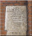
Old Boundary Marker by the B160, St Paul's Way, Poplar Parish
Parish Boundary Marker by the B140, in parish of Poplar (Tower Hamlets District), St Paul's Way E3, junction of Bow Common Lane, on wall of RC church, above MX_BSL06pb
Image
Surveyed
Milestone Society National ID: MX_BSL05pb
Image: © Milestone Society
Taken: Unknown
0.14 miles
10
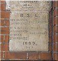
Old Boundary Marker by the B140, St Paul's Way, Poplar Parish
Parish Boundary Marker by the B140, in parish of Poplar (Tower Hamlets District), St Paul's Way E3, junction with Bow Common Lane, on wall of RC church below MX_BSL05pb
Image
Surveyed
Milestone Society National ID: MX_BSL06pb
Image: © Milestone Society
Taken: Unknown
0.14 miles


