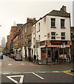
IMAGES TAKEN NEAR TO
Romford Street, LONDON, E1 1HX

Introduction

This page details the photographs taken nearby to Romford Street, E1 1HX by members of the Geograph project.

The Geograph project started in 2005 with the aim of publishing, organising and preserving representative images for every square kilometre of Great Britain, Ireland and the Isle of Man.

There are currently over 7.5m images from over14,400 individuals and you can help contribute to the project by visiting https://www.geograph.org.uk

Image Map


Images are licensed for reuse under creativecommons.org/licenses/by-sa/2.0
Notes
  • Clicking on the map will re-center to the selected point.
  • The higher the marker number, the further away the image location is from the centre of the postcode.

Image Listing (367 Images Found)

Images are licensed for reuse under creativecommons.org/licenses/by-sa/2.0
  • ...
Image
Details
Distance
1
"The London"
The Royal London Hospital Whitechapel. Home to Joseph Merrick (the Elephant Man) and the lifesaver for many caught up in the 7th of July 2005 bombings. The Air Ambulance helipad can clearly be seen on top of the building to the right.
Image: © Glyn Baker Taken: 12 Aug 2005
0.00 miles
2
Whitechapel bell foundry
The Whitechapel bell foundry is one of very few remaining foundries. The office building shown here fronts onto the main Whitechapel Road (A11) with the factory behind.
Image: © Stephen Craven Taken: 30 Apr 2006
0.00 miles
3
London skyline
View from Dartmouth Park, North London
Image: © Jim Osley Taken: 12 Jun 2016
0.03 miles
4
Fieldgate Mansions sign, Myrdle Street E1
Image: © Robin Sones Taken: 14 Aug 2013
0.04 miles
5
Old Boundary Marker by Murdle Street, Stepney parish
Parish Boundary Marker by the UC road, in parish of Stepney (Tower Hamlets District), Myrdle Street E1, near junction with Fieldgate Street on low wall, West side of road. Inscription weathered. Surveyed Milestone Society National ID: MX_MEOT04pb
Image: © Milestone Society Taken: Unknown
0.05 miles
6
View up Fordham Street from Settles Street
Looking north-northeast.
Image: © Robert Lamb Taken: 4 May 2014
0.05 miles
7
Myrdle Street, Whitechapel
Image: © Alex McGregor Taken: 27 Jul 2010
0.05 miles
8
Fieldgate Street, E1
Seen from Stepney Way across the crossroads with New Road. Prominent with its green corner domes is the 1902 Tower House at number 81, one of six former Rowton Houses built in London as hostels for working men.
Image: © Derek Harper Taken: 1 Feb 2011
0.05 miles
9
Fieldgate Mansions (and dumped mattress)
Fieldgate Mansions were scheduled for demolition in 1972. They were saved from demolition by squatters. A housing association took them over in 1980 and modernised. See http://philmaxwell.org/?p=2362 for some excellent old photos. More recently they have attracted infamy as the place where Marc Blanco died under suspicious circumstances at a party attended by Pete Doherty. http://www.bbc.co.uk/news/uk-20629287
Image: © Bikeboy Taken: 24 Dec 2012
0.06 miles
10
New Road, Whitechapel
Image: © Chris Whippet Taken: 8 Jan 2009
0.06 miles
  • ...