1
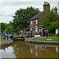
Atherstone Top Lock and cottage, Warwickshire
Atherstone Top Lock, No 1.
On the Coventry Canal, the Atherstone flight of eleven locks lowers (or raises) the water level by eighty feet (24.4 metres) over about two miles (three kilometres). As the canal company had run out of money by 1771 when it reached Atherstone on its course from Coventry, these locks and the rest of the route were constructed later, eventually arriving at Fazeley in 1790.
Image: © Roger D Kidd
Taken: 19 Aug 2013
0.03 miles
2
Top Lock Cottage, Atherstone
On the Coventry Canal.
Image: © Andrew Abbott
Taken: 1 May 2023
0.03 miles
3
Coventry Canal towards bridge #41
Image: © Ian S
Taken: 6 Jan 2022
0.03 miles
4
Coventry Canal, Atherstone
I am by the tail of the top lock and looking down the flight. Note the fake heron by the water issuing from the bypass. Lock No. 2 is seen in the distance.
Image: © Chris Allen
Taken: 10 Nov 2018
0.03 miles
5
Atherstone Locks No 2 in Warwickshire
This is the Coventry Canal, looking north-west towards Lock No 2, from Top Lock No 1.
The Atherstone flight of eleven locks lowers (or raises) the water level by eighty feet (24.4 metres) over about two miles (three kilometres). As the canal company had run out of money by 1771 when it reached Atherstone on its course from Coventry, these locks and the rest of the route were constructed later, eventually arriving at Fazeley in 1790.
Image: © Roger Kidd
Taken: 22 Sep 2016
0.03 miles
6
The last one, Atherstone ? 1978
Kimberley is about to enter Atherstone Top Lock at the end of the flight. By 2010 https://www.geograph.org.uk/photo/6777061 there was significant additional tree growth, as well as improvements to the towpath.
Atherstone Top Lock is Listed Grade II, the Listing including the pound in the foreground.
Image: © Alan Murray-Rust
Taken: 10 Jun 1978
0.03 miles
7
Atherstone Top Lock in Warwickshire
The view of Atherstone Top Lock, No 1 looks north-west towards Lock No 2.
The Atherstone flight of eleven locks lowers (or raises) the water level by eighty feet (24.4 metres) over about two miles (three kilometres). As the canal company had run out of money by 1771 when it reached Atherstone on its course from Coventry, these locks and the rest of the route were constructed later, eventually arriving at Fazeley in 1790.
Image: © Roger Kidd
Taken: 22 Sep 2016
0.03 miles
8
The bottom gates of Atherstone Top Lock ? 1978
Compare with the much more sanitised surroundings and towpath in 2008 https://www.geograph.org.uk/photo/1139321
Top Lock and the basin below it are Listed Grade II.
Image: © Alan Murray-Rust
Taken: 10 Jun 1978
0.03 miles
9
Lock keeper's cottage at Atherstone, Warwickshire
I managed to avoid the overblown hype and forced excitement for most of the week, but not here at Atherstone Top Lock on the Coventry Canal.
Note: The occupant supports England in the 2010 FIFA world cup. We sympathise with his predicament. Eat some chocolate.
Image: © Roger D Kidd
Taken: 19 Jun 2010
0.04 miles
10
Atherstone Locks No 2 in Warwickshire
This is the Coventry Canal, looking north-west towards Lock No 2, from Top Lock No 1.
The Atherstone flight of eleven locks lowers (or raises) the water level by eighty feet (24.4 metres) over about two miles (three kilometres). As the canal company had run out of money by 1771 when it reached Atherstone on its course from Coventry, these locks and the rest of the route were constructed later, eventually arriving at Fazeley in 1790.
Image: © Roger Kidd
Taken: 22 Sep 2016
0.04 miles


