1
Heathcote Lane
Heading west.
Image: © JThomas
Taken: 4 Apr 2013
0.01 miles
2
Trident Park landscape setting
It feels like south Leamington but the stream that miraculously survives here forms the parish boundary between Warwick and Whitnash. The Trident Technology and Business Centre, a division of Warwickshire College college of further education, is one of only two developments to have materialized on Trident Park: one business park too many? Excellent blackberries - a notable feature of local business parks and industrial estates currently.
Image: © Robin Stott
Taken: 30 Jul 2009
0.03 miles
3
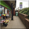
My Coffee Station, Co-operative Food, Cressida Close, Heathcote, Leamington
Image: © Robin Stott
Taken: 7 Jun 2018
0.04 miles
4
Lighting columns, Heathcote Lane
Approaching the junction with Poseidon Way and Othello Avenue, at a cloudy moment.
Image: © Robin Stott
Taken: 22 Aug 2009
0.04 miles
5
Co-op Store at Warwickgates
District Centre including convenience store, takeaways and chemist.
Image: © David Walton
Taken: 10 Feb 2002
0.04 miles
6
Garden of the Royal Horse public house, Heathcote Lane, Leamington
The shiny building on the right is the new Engineering Facility for Warwick Trident College, part of the Warwickshire College Group. The church spire on the skyline is of St John's, Tachbrook Street. There are glimpses of businesses and industry in the area.
Image: © Robin Stott
Taken: 29 Dec 2015
0.04 miles
7
The Royal Horse public house, Heathcote Lane, Leamington
Busy in the days after Christmas. The name may be an allusion to the presence of an Army veterinary unit in Leamington during the Great War.
Image: © Robin Stott
Taken: 29 Dec 2015
0.04 miles
8
Junction of Poseidon Way and Heathcote Lane, south Leamington
Business and industry in south Leamington are still undergoing a slow transformation. On the left, Exchange Place, possibly home to the Focus Learning Trust; some websites say it is available to rent. The long white fascia is on the ageing single-storey premises of Caparo. Beyond it the colossal Wolseley warehouse for building materials and components, dating from just before the financial crisis of 2008: unfortunate timing
Image The fence on the right is to the garden of the more recent Royal Horse public house.
Image: © Robin Stott
Taken: 29 Dec 2015
0.05 miles
9
Surface water holding lagoon near Heathcote Lane
Actually a watercourse, at the north-east corner of the Warwick Gates estate. It also appears in:
Image Giving this area a name is problematic: it's near to Whitnash, yes, but it feels like south Leamington, and this side of the brook is technically in Warwick; the other side is in the parish of Bishop's Tachbrook.
Image: © Robin Stott
Taken: 22 Aug 2009
0.06 miles
10
Warwick Gates Community Church and church hall, Cressida Close, Leamington
This is part of a local centre for the Warwick Gates estate and passing trade on Heathcote Lane. There's a doctor's surgery to the left and local shops, including a Co-op convenience store, to the right.
Image: © Robin Stott
Taken: 29 Dec 2015
0.07 miles


