1
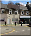
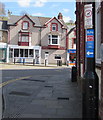
Cavanna's convenience store, Commercial Street, Senghenydd
Viewed in March 2019. The village post office has been in this convenience store
since 2013. The post office was previously in High Street, seen here https://www.geograph.org.uk/photo/2922766 in April 2012.
Image: © Jaggery
Taken: 26 Mar 2019
0.00 miles
2
Cavanna's, 116-118 Commercial Street, Senghenydd
Viewed in March 2019. The village post office has been in this convenience store
since 2013. The post office was previously in High Street, seen here https://www.geograph.org.uk/photo/2922766 in April 2012.
Image: © Jaggery
Taken: 26 Mar 2019
0.01 miles
3
Sonia's Plaice, 1 High Street, Senghenydd
In March 2019 Sonia's Plaice fish & chips shop is in premises formerly
occupied by Brenda's fish & chips shop seen here https://www.geograph.org.uk/photo/2924512 in April 2012.
Image: © Jaggery
Taken: 26 Mar 2019
0.01 miles
4
The Square, Senghenydd
War memorial in the centre.
Image: © John Lord
Taken: 5 Oct 2017
0.01 miles
5
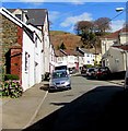
Windsor Place, Senghenydd
Looking to the northeast along Windsor Place towards Commercial Street and Caerphilly Road.
Image: © Jaggery
Taken: 26 Mar 2019
0.01 miles
6
Senghenydd Pharmacy, High Street, Senghenydd
Viewed in March 2019. The pharmacy is in premises formerly occupied
by the village post office seen here https://www.geograph.org.uk/photo/2922766 in April 2012.
Image: © Jaggery
Taken: 26 Mar 2019
0.02 miles
7
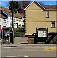
BT phonebox on a Senghenydd corner
On the corner of Commercial Street and Caerphilly near a village noticeboard.
A dark green telecoms cabinet is in the background.
Image: © Jaggery
Taken: 26 Mar 2019
0.02 miles
8
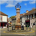
Senghenydd War Memorial
The Memorial is a clock tower located in the centre of Senghenydd at the junction of High Street, Commercial Street and Gwern Avenue. It was dedicated on March 1st 1921 in memory of the 62 men from the village who were killed in the Great War (now usually known as the First World War). The names of those killed in the Second World War were added shortly after the end of that war. Grade II listed in 1999.
Image: © Jaggery
Taken: 26 Mar 2019
0.02 miles
9
Cycle route 475 direction sign on a Gwern Avenue lamppost, Senghenydd
National Cycle Network Route 475 (Aber Cycleway) extends for 4km from Senghenydd to Caerphilly via Abertriwdr.
Image: © Jaggery
Taken: 26 Mar 2019
0.02 miles
10
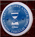
Gwern y Milwr Hotel blue plaque, Senghenydd
The Caerphilly County Borough Council Walking Through Time Welsh/English
blue plaque is on the wall of this https://www.geograph.org.uk/photo/2924113 building.
Image: © Jaggery
Taken: 26 Mar 2019
0.02 miles


