1
St Paul's Close, Dinas Powys
Viewed across St Cadoc's Avenue.
Image: © Jaggery
Taken: 11 Aug 2016
0.01 miles
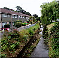
2
East Brook south of St Lythan Close, Dinas Powys
Viewed from the railings here. http://www.geograph.org.uk/photo/5109325
Image: © Jaggery
Taken: 11 Aug 2016
0.01 miles
3
Telecoms cabinet on a Dinas Powys corner
On the corner of St Cadoc's Avenue and St Winifred's Close.
Image: © Jaggery
Taken: 11 Aug 2016
0.03 miles
4
Kubota vehicles, St Cadoc's Avenue, Dinas Powys
The four-wheel drive vehicles are being used for spraying work.
Image: © Jaggery
Taken: 11 Aug 2016
0.04 miles
5
St Winifred's Close, Dinas Powys
Cul-de-sac viewed across St Cadoc's Avenue.
Image: © Jaggery
Taken: 11 Aug 2016
0.05 miles
6
Houses at the southern end of St Cadoc's Avenue, Dinas Powys
The backs of the houses are alongside East Brook.
Image: © Jaggery
Taken: 11 Aug 2016
0.05 miles
7
Sunnycroft electricity substation, St Cadoc's Avenue, Dinas Powys
The Western Power Distribution electricity substation identifier is SUNNYCROFT DINAS POW S/S 512228.
Image: © Jaggery
Taken: 11 Aug 2016
0.06 miles
8
Cardiff Road pelican crossing, Dinas Powys
The St Cadoc's Avenue junction is on the left. Chambers Dictionary states that pelican in this context is adapted from "pedestrian light controlled crossing".
Image: © Jaggery
Taken: 11 Aug 2016
0.06 miles
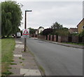
9
Warning sign - skid risk - maximum speed 10mph, Dinas Powys
The temporary sign is on a St Cadoc's Avenue lamppost.
Image: © Jaggery
Taken: 11 Aug 2016
0.06 miles
10
St Lythan Close, Dinas Powys
Cul-de-sac on the southeast side of St Cadoc's Avenue. The railings are above East Brook. http://www.geograph.org.uk/photo/5109328
Image: © Jaggery
Taken: 11 Aug 2016
0.07 miles


