IMAGES TAKEN NEAR TO
Incline Side, MERTHYR TYDFIL, CF48 4AH

Introduction

This page details the photographs taken nearby to Incline Side, CF48 4AH by members of the Geograph project.

The Geograph project started in 2005 with the aim of publishing, organising and preserving representative images for every square kilometre of Great Britain, Ireland and the Isle of Man.

There are currently over 7.5m images from over14,400 individuals and you can help contribute to the project by visiting https://www.geograph.org.uk

Image Map


Images are licensed for reuse under creativecommons.org/licenses/by-sa/2.0
Notes
  • Clicking on the map will re-center to the selected point.
  • The higher the marker number, the further away the image location is from the centre of the postcode.

Image Listing (7 Images Found)

Images are licensed for reuse under creativecommons.org/licenses/by-sa/2.0
Image
Details
Distance
1
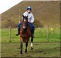
Horse and Rider Wales
Ethan Pitt riding a Horse at a Farm near Fochriw, Rhymney Valley The Horse is a Registered Cob and is being rode around the Paddock
Image: © Ethan Pitt Taken: 10 Oct 2012
0.06 miles
2
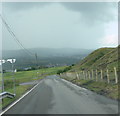
Barrier to Ffos-y-frân opencast site
Image: © Alan Hughes Taken: 20 Aug 2023
0.07 miles
3
Deep excavation warning sign, Merthyr Tydfil
Ffos-y-fran opencast coal mine is just over the ridge http://www.geograph.org.uk/photo/3016941 .
Image: © Robin Drayton Taken: 25 Jun 2012
0.08 miles
4
Entrance to Ffos-y-fr
Note: Fence on right not shown on O/S maps; it's been recently erected as the land is now being used as a Landfill Site. Left side unfenced until after turning and this is indicated on O/S maps.
Image: © Bonelli Taken: Unknown
0.13 miles
5
Opencast coal mine, Merthyr Tydfil
A glimpse of the large Ffos-y-fran opencast coal mine that is situated high above Merthyr Tydfil.
Image: © Robin Drayton Taken: 25 Jun 2012
0.20 miles
6
Hillside above Merthyr
Looking west towards the town in the valley below. Much evidence of mining and quarrying hereabouts.
Image: © Jonathan Billinger Taken: 14 Mar 2008
0.20 miles
7
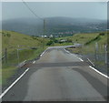
Cattle Grid
Note: New fence erected on right side of road - This because the area is now being used as a Landfill site ( O/S shows road unfenced )
Image: © Bonelli Taken: Unknown
0.24 miles