1
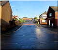
St John's Road, Tonyrefail
Ascending from the north side of High Street. The 30mph speed limit drops to 20 on the approach to a school.
Image: © Jaggery
Taken: 10 Jan 2018
0.16 miles
2
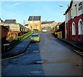
Collenna Road, Tonyrefail
Image: © Roger Cornfoot
Taken: 25 Apr 2007
0.16 miles
3
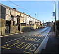
One-way side road on the west side of St John's Road, Tonyrefail
From St John's Road to School Street.
Image: © Jaggery
Taken: 10 Jan 2018
0.17 miles
4
Edwardian St David's Church, High Street, Tonyrefail
In the Church in Wales Parish of Tonyrefail, Diocese of Llandaff.
The church was built in 1902-1903 in the Early English style.
Image: © Jaggery
Taken: 10 Jan 2018
0.17 miles
5
Red Gate Close, Tonyrefail
On the north side of High Street. The Red Gate pub https://www.geograph.org.uk/photo/5649293 is on the right.
Image: © Jaggery
Taken: 10 Jan 2018
0.18 miles
6
St David's Church, Tonyrefail
Image: © John Lord
Taken: 1 Nov 2017
0.18 miles
7
Up Collenna Road, Tonyrefail
Collenna Road ascends from crossroads in the centre of Tonyrefail. This way to Trebanog and Porth.
The red cash dispenser on the left is in the side wall of the post office. https://www.geograph.org.uk/photo/5649561
Image: © Jaggery
Taken: 10 Jan 2018
0.19 miles
8
High Street bus stop, Tonyrefail
This stop for southbound buses is opposite St David's Church. https://www.geograph.org.uk/photo/5649702
Image: © Jaggery
Taken: 10 Jan 2018
0.19 miles
9
B & F Cars premises in High Street, Tonyrefail
Located in the Old Mazda Garage on the corner of St John's Road.
Image: © Jaggery
Taken: 10 Jan 2018
0.19 miles
10
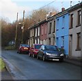
Cars and houses at the northern end of Station Road, Tonyrefail
Station Road is a dead-end road on the north side of Waunrhydd Road. Tonyrefail railway station closed in 1958. The present-day A4119 in this area uses the route of the dismantled railway.
Image: © Jaggery
Taken: 10 Jan 2018
0.19 miles


