1
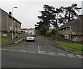
Queen's Road bilingual name sign, Bridgend
Queen's Road is Heol y Frenhines (or Heol-y-frenhines) in Welsh.
Image: © Jaggery
Taken: 16 Nov 2018
0.00 miles
2
West House electricity substation, Bridgend
The green cabinet set back from the west of Heol-y-frenhines is a Western Power Distribution electricity substation. Its identifier is West House Bridgend 56-4011
Image: © Jaggery
Taken: 16 Nov 2018
0.01 miles
3
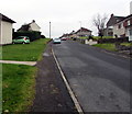
Up Heol-y-frenhines, Bridgend
This part of Heol-y-frenhines is between the Sunny Hill junction and the Elizabeth Road junction (ahead).
Image: © Jaggery
Taken: 16 Nov 2018
0.01 miles
4
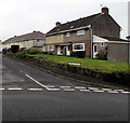
Rooftop solar panels near a suburban corner, Bridgend
On a Heol-y-frenhines roof on the left and an Elizabeth Road roof on the right.
Image: © Jaggery
Taken: 16 Nov 2018
0.03 miles
5
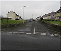
Elizabeth Road, Bridgend
Elizabeth Road viewed across Heol-y-frenhines.
Image: © Jaggery
Taken: 16 Nov 2018
0.04 miles
6
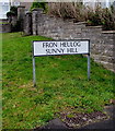
Fron Heulog/Sunny Hill name sign, Bridgend
The Welsh/English sign is on the left here. https://www.geograph.org.uk/photo/5976681
Image: © Jaggery
Taken: 16 Nov 2018
0.04 miles
7
Down Heol-y-frenhines, Bridgend
Heol-y-frenhines (Queen's Road in English) https://www.geograph.org.uk/photo/5984330 descends towards Heol-y-nant which leads to the A473 Park Street.
Image: © Jaggery
Taken: 16 Nov 2018
0.04 miles
8
Dead-end side arm of Heol-y-frenhines, Bridgend
On the west side of the main route of Heol-y-frenhines.
Image: © Jaggery
Taken: 16 Nov 2018
0.05 miles
9
Elizabeth Road houses, Bridgend
Viewed from Heol-y-frenhines.
Image: © Jaggery
Taken: 16 Nov 2018
0.05 miles
10
Sunny Hill, Bridgend
Sunny Hill (Fron Heulog in Welsh https://www.geograph.org.uk/photo/5976686 ) viewed across Heol-y-frenhines.
Image: © Jaggery
Taken: 16 Nov 2018
0.05 miles


