IMAGES TAKEN NEAR TO
Grafton Close, CARDIFF, CF23 9JB

Introduction

This page details the photographs taken nearby to Grafton Close, CF23 9JB by members of the Geograph project.

The Geograph project started in 2005 with the aim of publishing, organising and preserving representative images for every square kilometre of Great Britain, Ireland and the Isle of Man.

There are currently over 7.5m images from over14,400 individuals and you can help contribute to the project by visiting https://www.geograph.org.uk

Image Map


Images are licensed for reuse under creativecommons.org/licenses/by-sa/2.0
Notes
  • Clicking on the map will re-center to the selected point.
  • The higher the marker number, the further away the image location is from the centre of the postcode.

Image Listing (7 Images Found)

Images are licensed for reuse under creativecommons.org/licenses/by-sa/2.0
Image
Details
Distance
1
Converted water tower, Cyncoed, Cardiff
Now a dwelling. The conversion won a Gold Medal for the architects, Chris Loyn,at the National Eisteddfod, 2007
Image: © John Lord Taken: 13 Jan 2010
0.17 miles
2
Junction, Llanedeyrn
Llanedeyrn Drive meets Circle Way West at a T junction.
Image: © Derek Harper Taken: 16 Jun 2018
0.17 miles
3
Llanedeyrn Road
At the junction with Oak Wood Avenue. Service roads parallel the road on either side, providing access to houses.
Image: © Derek Harper Taken: 16 Jun 2018
0.21 miles
4
Water tower, Cyncoed Road, Cardiff
Image: © Gareth James Taken: 9 Jun 2010
0.22 miles
5
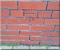
Ordnance Survey Cut Mark
This OS cut mark can be found on No8 Llanedeyrn Road. It marks a point 58.753m above mean sea level.
Image: © Adrian Dust Taken: 19 Nov 2017
0.22 miles
6
Paths and subway, Llanedeyrn
The subway leads under Llanedeyrn Drive. Does this count as a grass triangle?
Image: © Derek Harper Taken: 16 Jun 2018
0.24 miles
7
Water Tower
Grade II listed former water tower, first built in 1898 - now converted for residential use.
Image: © Alan Hughes Taken: 1 Nov 2017
0.25 miles