IMAGES TAKEN NEAR TO
Clos Tecwyn, CARDIFF, CF23 5ND

Introduction

This page details the photographs taken nearby to Clos Tecwyn, CF23 5ND by members of the Geograph project.

The Geograph project started in 2005 with the aim of publishing, organising and preserving representative images for every square kilometre of Great Britain, Ireland and the Isle of Man.

There are currently over 7.5m images from over14,400 individuals and you can help contribute to the project by visiting https://www.geograph.org.uk

Image Map


Images are licensed for reuse under creativecommons.org/licenses/by-sa/2.0
Notes
  • Clicking on the map will re-center to the selected point.
  • The higher the marker number, the further away the image location is from the centre of the postcode.

Image Listing (25 Images Found)

Images are licensed for reuse under creativecommons.org/licenses/by-sa/2.0
  • ...
Image
Details
Distance
1
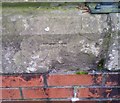
Cut Benchmark - Birchwood Road
A cut benchmark on the gatepost of the college entrance on Birchwood Road
Image: © Father Ted Taken: 2 Jul 2020
0.10 miles
2
University Hall, Penylan, Cardiff
Viewed from Ty Gwyn Road. The multi-storey university hall is located on Birchwood Lane. It has accommodation for 673 students, either in standard rooms with shared bathroom facilities, or 251 more expensive rooms with en-suite facilities.
Image: © Jaggery Taken: 11 Oct 2010
0.10 miles
3
Entrance to Ty Gwyn School Annexe, Cardiff
Viewed across Ty Gwyn Road. The Annexe is part of Ty Gwyn School. The main building is in Vincent Road, Ely, Cardiff. Ty Gwyn is a local authority day special school for children and young people (aged 3–19) who have profound and multiple learning difficulties.
Image: © Jaggery Taken: 11 Oct 2010
0.14 miles
4
Ordnance Survey Cut Mark
This OS cut mark can be found on the gatepost of No93 Cyncoed Road. It marks a point 61.472m above mean sea level.
Image: © Adrian Dust Taken: 19 Nov 2017
0.17 miles
5
Ordnance Survey Cut Mark
This OS cut mark can be found on the wall of Cornborough House, Cyncoed Road. It marks a point 63.136m above mean sea level.
Image: © Adrian Dust Taken: 19 Nov 2017
0.20 miles
6
Corner of Ty Gwyn Road and Cyncoed Road, Cardiff
Detached house on the southern corner of Cyncoed Road and Ty Gwyn Road (on the right).
Image: © Jaggery Taken: 11 Oct 2010
0.20 miles
7
Ordnance Survey Cut Mark
This OS cut mark can be found on the rear wall of Tower House. It marks a point 27.685m above mean sea level.
Image: © Adrian Dust Taken: 19 Nov 2017
0.22 miles
8
Ordnance Survey Cut Mark
This OS cut mark can be found on the wall between Nos54 & 56 Lake Road East. It marks a point 22.223m above mean sea level.
Image: © Adrian Dust Taken: 19 Nov 2017
0.22 miles
9
Roath Park Lake - frozen
Image: © Gareth James Taken: 9 Jan 2010
0.22 miles
10
Roath Park Gateway - Cardiff
With the Hanging Gardens of Roath beyond.
Image: © Mick Lobb Taken: 28 Apr 2010
0.22 miles
  • ...