1
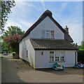
Whittlesford: thatch and plaster on Vicarage Lane
This is not one of the many Grade II listed historic houses in the village.
Image: © John Sutton
Taken: 17 Jun 2022
0.01 miles
2
Whittlesford: Swallow Croft
Bungalows round a small green off Vicarage Lane.
Image: © John Sutton
Taken: 17 Jun 2022
0.03 miles
3
Whittlesford: West End - white walls and wisteria
A cloudless Sunday morning in late April.
Image: © John Sutton
Taken: 26 Apr 2020
0.06 miles
4
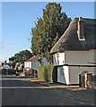
Whittlesford: West End in December
The thatched house, Charity Farm, is Grade II listed.
Image: © John Sutton
Taken: 4 Dec 2016
0.07 miles
5
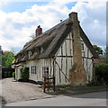
Whittlesford: Reeds Cottage
A Grade II listed 17th-century timber-framed house on West End.
Image: © John Sutton
Taken: 26 Apr 2018
0.08 miles
6
Whittlesford: West End - blue sky and white walls
These are three of many Grade II listed houses in the village. Charity Farmhouse, on the left, dates from the early sixteenth century. A blue-sky day followed torrential downpours the evening before.
Image: © John Sutton
Taken: 29 Sep 2021
0.08 miles
7
Whittlesford: white walls in West End
Charity Farmhouse, on the left, dates from the first part of the sixteenth century, the hipped-roofed house from the early nineteenth. Both are Grade II listed.
Image: © John Sutton
Taken: 1 Sep 2019
0.08 miles
8
Whittlesford: historic houses on West End
Charity Farmhouse, on the left, dates from the early 16th century and the humbler cottages on the corner from a little later. Both are timber-framed, thatched and Grade II listed.
Image] (September 2021) is a view towards Charity Farm.
Image: © John Sutton
Taken: 17 Jun 2022
0.08 miles
9
Whittlesford: Markings Farmhouse
16th-century in origin and Grade II listed.
Image: © John Sutton
Taken: 4 Dec 2016
0.08 miles
10
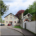
Whittlesford: a former factory
Maynard's was an agricultural-implement factory, later acquired by Phoenix Tinsel Products, makers of artificial Christmas trees, decorative lighting and display goods. It is now in residential use. The bargeboards on the former office are splendidly ornate.
Image: © John Sutton
Taken: 26 Apr 2018
0.08 miles


