IMAGES TAKEN NEAR TO
Salmoor Way, MARYPORT, CA15 8AZ

Introduction

This page details the photographs taken nearby to Salmoor Way, CA15 8AZ by members of the Geograph project.

The Geograph project started in 2005 with the aim of publishing, organising and preserving representative images for every square kilometre of Great Britain, Ireland and the Isle of Man.

There are currently over 7.5m images from over14,400 individuals and you can help contribute to the project by visiting https://www.geograph.org.uk

Image Map


Images are licensed for reuse under creativecommons.org/licenses/by-sa/2.0
Notes
  • Clicking on the map will re-center to the selected point.
  • The higher the marker number, the further away the image location is from the centre of the postcode.

Image Listing (129 Images Found)

Images are licensed for reuse under creativecommons.org/licenses/by-sa/2.0
  • ...
Image
Details
Distance
1
Ordnance Survey Cut Mark & Roman Numerals
These marks can be found on the old wall at the SE corner of the Elizabeth Dock.
Image: © Adrian Dust Taken: 27 Mar 2018
0.05 miles
2
Ellen Wharf
A new development of houses and apartments near the docks, nearing completion
Image: © Alexander P Kapp Taken: 19 Sep 2007
0.06 miles
3
Maryport Harbour
Image: © Pat Pierpoint Taken: 24 Dec 2005
0.06 miles
4
Footbridge over the River Ellen, Maryport
Image: © JThomas Taken: 23 Nov 2019
0.06 miles
5
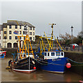
Elizabeth Dock, Maryport
Maryport registered fishing boats Silver Fern and Chelaris. Note the Brexit flag.
Image: © Ian Taylor Taken: 12 Mar 2019
0.06 miles
6
Maryport Harbour in 1989
Two of the historic ships connected with the Maryport Maritime Museum at that time at berth
Image: © Kevin Waterhouse Taken: Unknown
0.06 miles
7
New homes at Ritson Wharf
Sandwiched between Irish Street and the River Ellen to the east, and the former Elizabeth Dock to the west.
Image: © Christine Johnstone Taken: 28 Feb 2013
0.06 miles
8
Elizabeth Dock, Maryport
Built in 1857. Still used by fishing boats, but with new housing down the eastern side.
Image: © Christine Johnstone Taken: 28 Feb 2013
0.07 miles
9
Maryport Harbour
Another view of the new buildings around this old commercial harbour. The historic vessel is the 1951 steam tug Flying Buzzard (aka Harecraig II). She has now sailed for new waters with a diesel in place of her 1150 horsepower compound steam engine (the latter is in the Scottish Maritime Museum, Irvine).
Image: © Chris Allen Taken: 29 Jun 2002
0.08 miles
10
Elizabeth Dock, Maryport
Fishing boats moored in Elizabeth Dock, Maryport, Cumbria.
Image: © Richard Thomas Taken: 14 May 2014
0.08 miles
  • ...