IMAGES TAKEN NEAR TO
Goldney Avenue, BRISTOL, BS8 4RA

Introduction

This page details the photographs taken nearby to Goldney Avenue, BS8 4RA by members of the Geograph project.

The Geograph project started in 2005 with the aim of publishing, organising and preserving representative images for every square kilometre of Great Britain, Ireland and the Isle of Man.

There are currently over 7.5m images from over14,400 individuals and you can help contribute to the project by visiting https://www.geograph.org.uk

Image Map


Images are licensed for reuse under creativecommons.org/licenses/by-sa/2.0
Notes
  • Clicking on the map will re-center to the selected point.
  • The higher the marker number, the further away the image location is from the centre of the postcode.

Image Listing (471 Images Found)

Images are licensed for reuse under creativecommons.org/licenses/by-sa/2.0
  • ...
Image
Details
Distance
1
Start of pathway to Goldney Lane, Clifton Wood
Close to the exit of the nearby cemetery, it leads steeply downhill to Hotwells and Bristol Harbour. It is the most direct pedestrian route to the Harbour from the centre of Clifton via Victoria Square. The buildings at the left are part of Bristol University.
Image: © Anthony O'Neil Taken: 12 Jul 2010
0.02 miles
2
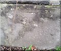
Ordnance Survey Cut Mark
This OS cut mark can be found on the wall north side of Goldney Avenue. It marks a point 63.764m above mean sea level.
Image: © Adrian Dust Taken: 3 Jan 2020
0.03 miles
3
An entrance to Emmaus House on Goldney Avenue
The house has a rear entrance here on what was previously called Fry's Hill. The lane carries pedestrians up to Clifton's Regent street. Meanwhile, a nineteenth century benchmark can be seen on the pier - see Image
Image: © Neil Owen Taken: 4 Mar 2022
0.03 miles
4
Ordnance Survey Cut Mark
This very worn OS cut mark can be found on the post north side of Clifton Hill. It marks a point 66.998m above mean sea level.
Image: © Adrian Dust Taken: 3 Jan 2020
0.04 miles
5
Ordnance Survey Cut Mark
This OS cut mark can be found on the gatepost north side of Goldney Avenue. It marks a point 52.916m above mean sea level.
Image: © Adrian Dust Taken: 3 Jan 2020
0.04 miles
6
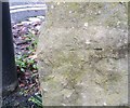
Benchmark on Goldney Avenue
An old cutmark is listed in the Benchmark Database: https://www.bench-marks.org.uk/bm86286 . See Image] for a wider view.
Image: © Neil Owen Taken: 4 Mar 2022
0.04 miles
7
Passageway
Clifton Hill
Image: © Anthony O'Neil Taken: 8 May 2020
0.04 miles
8
Patch, Gromit No.47
Patch, Gromit No.47, located at Clifton Hill, one of 80 Gromits currently on display in Bristol and its environs. Artist: Emily Golden.
Image: © Philip Halling Taken: 18 Aug 2013
0.04 miles
9
Pines, Regent Street, Bristol
The same trees as seen here Image
Image: © Stephen Richards Taken: 22 May 2012
0.04 miles
10
Marking V.E. Day
Goldney Avenue
Image: © Anthony O'Neil Taken: 8 May 2020
0.04 miles
  • ...