IMAGES TAKEN NEAR TO
Worcester Crescent, BRISTOL, BS8 3JA

Introduction

This page details the photographs taken nearby to Worcester Crescent, BS8 3JA by members of the Geograph project.

The Geograph project started in 2005 with the aim of publishing, organising and preserving representative images for every square kilometre of Great Britain, Ireland and the Isle of Man.

There are currently over 7.5m images from over14,400 individuals and you can help contribute to the project by visiting https://www.geograph.org.uk

Image Map


Images are licensed for reuse under creativecommons.org/licenses/by-sa/2.0
Notes
  • Clicking on the map will re-center to the selected point.
  • The higher the marker number, the further away the image location is from the centre of the postcode.

Image Listing (342 Images Found)

Images are licensed for reuse under creativecommons.org/licenses/by-sa/2.0
  • ...
Image
Details
Distance
1
Georgian letterbox on Clifton Park Road
Box BS8 414D, a Georgian type by W.T. Allen. See Image] for a location view.
Image: © Neil Owen Taken: 1 Jul 2021
0.01 miles
2
Letterbox on Clifton Park Road
See Image] for a better view.
Image: © Neil Owen Taken: 1 Jul 2021
0.01 miles
3
Doctor's garage
A delightfully old-fashioned wooden sign, showing a little age.
Image: © Neil Owen Taken: 1 Jul 2021
0.03 miles
4
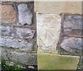
Ordnance Survey Cut Mark
This damaged and worn OS cut mark can be found on the wall of No52 Clifton Park Road. It marked a point 68.355m above mean sea level.
Image: © Adrian Dust Taken: 2 Jan 2020
0.03 miles
5
By Clifton High School
A scene on Clifton Park Road. The spire belongs to Christ Church http://www.geograph.org.uk/search.php?i=87221516 .
Image: © Derek Harper Taken: 13 Sep 2018
0.04 miles
6
Ordnance Survey Cut Mark
This damaged OS cut mark can be found on the wall of Roosevelt Cottage, College Road. It marks a point 69.177m above mean sea level.
Image: © Adrian Dust Taken: 2 Jan 2020
0.05 miles
7
An entrance to Clifton High School
The entrance is an old one and predates much of the present school buildings. On its base is a benchmark - see Image
Image: © Neil Owen Taken: 1 Jul 2021
0.05 miles
8
Ordnance Survey Cut Mark
This OS cut mark can be found at the entrance to the school on Clifton Park Road. It marks a point 73.759m above mean sea level.
Image: © Adrian Dust Taken: 2 Jan 2020
0.05 miles
9
Benchmark on Clifton High School doorway
A slightly battered mark, as listed in the Benchmark Database: https://www.bench-marks.org.uk/bm72458 . See Image] for a wider view.
Image: © Neil Owen Taken: 1 Jul 2021
0.05 miles
10
Bristol : College Road
Looking along College Road as it heads through Bristol.
Image: © Lewis Clarke Taken: 19 Jul 2015
0.06 miles
  • ...