IMAGES TAKEN NEAR TO
Woodland Terrace, BRISTOL, BS6 6LR

Introduction

This page details the photographs taken nearby to Woodland Terrace, BS6 6LR by members of the Geograph project.

The Geograph project started in 2005 with the aim of publishing, organising and preserving representative images for every square kilometre of Great Britain, Ireland and the Isle of Man.

There are currently over 7.5m images from over14,400 individuals and you can help contribute to the project by visiting https://www.geograph.org.uk

Image Map


Images are licensed for reuse under creativecommons.org/licenses/by-sa/2.0
Notes
  • Clicking on the map will re-center to the selected point.
  • The higher the marker number, the further away the image location is from the centre of the postcode.

Image Listing (401 Images Found)

Images are licensed for reuse under creativecommons.org/licenses/by-sa/2.0
  • ...
Image
Details
Distance
1
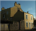
Houses on Hampton Road, Bristol
The house in the centre is on the corner of Hampton Road and Woodland Terrace (left), a listed terrace of about 1840 http://list.english-heritage.org.uk/resultsingle.aspx?uid=1202709&searchtype=mapsearch .
Image: © Derek Harper Taken: 27 Dec 2014
0.02 miles
2
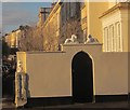
Lions on Hampton Road, Bristol
These lions can just about be made out in Image In the background is the listed Woodland Terrace http://list.english-heritage.org.uk/resultsingle.aspx?uid=1202709&searchtype=mapsearch .
Image: © Derek Harper Taken: 27 Dec 2014
0.02 miles
3
Clyde Arms, Redland
A pub at the junction of Hampton Road with Redland Park. A couple of smokers must be grateful for a mild and dry December evening.
Image: © Derek Harper Taken: 6 Dec 2015
0.03 miles
4
The Clyde at Redland
Traditional English public house at the junction of Hampton Road, and Redland Park.
Image: © Eirian Evans Taken: 20 Feb 2018
0.03 miles
5
Ordnance Survey Cut Mark
This OS cut mark can be found on The Clyde PH. It marks a point 68.205m above mean sea level.
Image: © Adrian Dust Taken: 16 Jan 2020
0.03 miles
6
Semis on Hampton Road, Bristol
These back onto Auburn Road.
Image: © Derek Harper Taken: 27 Dec 2014
0.03 miles
7
Blue plaque and postbox, Redland
On Clyde Road by the crossroads with Elgin Park, Hampton Road and Redland Park. The George V postbox is number BS6 267. The blue plaque is for Ada Vachell http://historyof.place/ada-vachell-a-life/ , who founded the Guild of Poor Things for children with disabilities. See also Image
Image: © Derek Harper Taken: 8 Oct 2017
0.03 miles
8
Foley Cottage
This view is from Clyde Road, looking right from Image], but its address is 130 Hampton Road. On the corner is the blue plaque to Ada Vachell, "feminist and champion of the rights of disabled people" http://historyof.place/ada-vachell-a-life/; see Image She died in this house in 1923.
Image: © Derek Harper Taken: 10 Sep 2022
0.04 miles
9
Graffiti on hoardings, Redland Park
Wishful thinking from the previous July. Perhaps the failure to complete the work involved at this substantial detached house is a consequence of the despair felt when "it" didn't quite come home.
Image: © Derek Harper Taken: 26 Dec 2021
0.05 miles
10
Leyton Villas, Redland
A short terrace of houses with polychrome canted bays, forming a cul-de-sac off Hampton Road. On the immediate left is the Redland Friends' Meeting House.
Image: © Derek Harper Taken: 27 Dec 2014
0.05 miles
  • ...