1
The Malago Greenway is quite colourful
Some typical expression on the pathway.
Image: © Neil Owen
Taken: 11 Dec 2023
0.04 miles
2
Roundabout at the B3120/B3122 junction, Bedminster, Bristol
At this junction, the B3120 St John's Lane from the NW meets the B3122 Bedminster Road from the SW and continues as the B3122 St John's Lane on the east side of the roundabout.
Image: © Jaggery
Taken: 5 Sep 2018
0.05 miles
3
Bristol St John's Lane - Church of Christ
Built in 1903.
Image: © ChurchCrawler
Taken: 4 Mar 2004
0.05 miles
4
Footbridge over the Malago
A steel footbridge, a replacement for the older one, but suffering from some serious rusting in places.
Image: © Neil Owen
Taken: 21 Apr 2022
0.05 miles
5
Broad Plain R.F.C. clubhouse
The local rugby club has a magnificent modern clubhouse here off St John's Lane. In the late 1800s, Bristol South End football club (later known as Bristol City F.C.) played here until 1904. The ground was given over to other clubs of various sports before the rugby club came here, along with a housing development. Part of the car park here used to be a bowling green, for example.
Image: © Neil Owen
Taken: 22 Feb 2022
0.05 miles
6
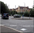
Roundabout on St John's Lane, Bedminster
Image: © David Howard
Taken: 1 Jun 2019
0.05 miles
7
Broad Plain's main pitch
The rugby club plays here. In the past it was the home of Bristol South End football club (later Bristol City), and a grandstand used to be right in the middle of the current playing field. Later it became a hockey pitch used by the D.R.G. club.
With the area a candidate for development, the scheme to build several townhouses and help the rugby club was agreed, giving the ground some sort of surrounding.
Image: © Neil Owen
Taken: 22 Feb 2022
0.06 miles
8
A small addition to the Malago
Having been slightly re-aligned in the modern re-development of the old gasometer site (now houses), the Malago now has a straighter run. A culvert allows a small drainage channel to join, channels that have been lost to development.
Image: © Neil Owen
Taken: 21 Apr 2022
0.06 miles
9
Benchmark on the Malago bridge
A cutmark (as listed in the Benchmark Database: ) on the small concrete wall that marks the course of the Malago river as it wanders towards the Avon, about a mile away. See
Image] for a wider view.
Image: © Neil Owen
Taken: 29 Dec 2011
0.07 miles
10
Malago bridge on Bedminster Road
The small Malago is channelled under the busy B3122 Bedminster Road, and the concrete wall prevents ingress. The local school has helped to liven the greyness with some enamelled artworks, which are visible on the right of the wall. On the left of it is a benchmark - see
Image
Image: © Neil Owen
Taken: 29 Dec 2011
0.07 miles


