IMAGES TAKEN NEAR TO
Lewes Road, LEWES, BN8 6BL

Introduction

This page details the photographs taken nearby to Lewes Road, BN8 6BL by members of the Geograph project.

The Geograph project started in 2005 with the aim of publishing, organising and preserving representative images for every square kilometre of Great Britain, Ireland and the Isle of Man.

There are currently over 7.5m images from over14,400 individuals and you can help contribute to the project by visiting https://www.geograph.org.uk

Image Map


Images are licensed for reuse under creativecommons.org/licenses/by-sa/2.0
Notes
  • Clicking on the map will re-center to the selected point.
  • The higher the marker number, the further away the image location is from the centre of the postcode.

Image Listing (41 Images Found)

Images are licensed for reuse under creativecommons.org/licenses/by-sa/2.0
  • ...
Image
Details
Distance
1
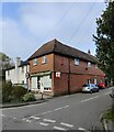
Woodside at Laughton
Numbers 1 and 2 Woodside beside the Lewes Road in Laughton.
Image: © Chris Thomas-Atkin Taken: 10 Mar 2019
0.01 miles
2
Laughton Rd
Image: © N Chadwick Taken: 15 Sep 2021
0.11 miles
3
Laughton Village Shop and Post Office
Image: © PAUL FARMER Taken: 12 Nov 2022
0.12 miles
4
Laughton Post Office
Image: © N Chadwick Taken: 15 Sep 2021
0.13 miles
5
Laughton Village Stores
Image: © Oast House Archive Taken: 16 Oct 2010
0.13 miles
6
Laughton Village Shop
The Village Shop and Post Office.
Image: © Chris Thomas-Atkin Taken: 25 Feb 2018
0.13 miles
7
Church Lane
Image: © N Chadwick Taken: 15 Sep 2021
0.14 miles
8
Coopers Brook
The name of the field according to the 1838 tithe map. The field has been expanded to include a smaller plot to the left though the original hedgerow trees remain to show the location of the old field boundary.
Image: © Simon Carey Taken: 3 Jun 2010
0.14 miles
9
The Roebuck sign
Image Also see old sign Image
Image: © Oast House Archive Taken: 16 Oct 2010
0.15 miles
10
Laughton Village sign
Showing the Pelham buckle
Image: © Julian P Guffogg Taken: 29 Oct 2011
0.15 miles
  • ...