IMAGES TAKEN NEAR TO
The Croft, Chatsworth Road, BRIGHTON, BN1 5DT

Introduction

This page details the photographs taken nearby to The Croft, Chatsworth Road, BN1 5DT by members of the Geograph project.

The Geograph project started in 2005 with the aim of publishing, organising and preserving representative images for every square kilometre of Great Britain, Ireland and the Isle of Man.

There are currently over 7.5m images from over14,400 individuals and you can help contribute to the project by visiting https://www.geograph.org.uk

Image Map


Images are licensed for reuse under creativecommons.org/licenses/by-sa/2.0
Notes
  • Clicking on the map will re-center to the selected point.
  • The higher the marker number, the further away the image location is from the centre of the postcode.

Image Listing (153 Images Found)

Images are licensed for reuse under creativecommons.org/licenses/by-sa/2.0
  • ...
Image
Details
Distance
1
Brighton: Stafford Road
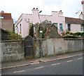
Please see Simon's Image for the history of the road. The dark green house in his image is visible on the left side of this one.
Image: © Nigel Cox Taken: 8 Jun 2008
0.02 miles
2
Stafford Road
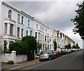
The road connects Port Hall Road to Buxton Road and was constructed slightly later than the rest of the area around the early 1890s as lower middle class housing as opposed to the other streets laid out at the same time which tended to be red brick upper middle class.
Image: © Simon Carey Taken: 29 Aug 2007
0.04 miles
3
Al Quds Mosque, Dyke Road
Opposite the sixth form college. This converted house has been a mosque for over 30 years and was an stop off point in the early 1980s for the notorious Abu Hamza when he was studying at a local university and working as a nightclub bouncer.
Image: © Simon Carey Taken: 29 Aug 2007
0.04 miles
4
Chatsworth Court
Opposite Image on the other corner of Port Hall Road and Dyke Road.
Image: © Simon Carey Taken: 29 Aug 2007
0.04 miles
5
Brighton: The Chimney House gastropub
This was formerly the Marquess of Exeter in Exeter Street, and the coats of arms in the pediments reflect this. The refurbishment work evidently in progress in Simon's Image has now been completed. The Chimney House's website is here http://www.chimneyhouse.co.uk/index.php
Image: © Nigel Cox Taken: 8 Jun 2008
0.05 miles
6
Port Hall
The house from which the suburb and a number of roads takes its name. Built in 1800 by Sir Paige-Dyck it was then an isolated house on the downs with just a windmill behind it to keep it company. The sham ecclesiastical window has a statue of a monk in it whilst a similar statue of a knight can just be made out over the front door. This view is taken from Port Hall Road looking sideways onto the property that actually faces out onto Dyke Road.
Image: © Simon Carey Taken: 29 Aug 2007
0.06 miles
7
Port Hall Road
Note the change of styles in the terraces as it heads up the hill. Completed by 1884 as a middle class suburb.
Image: © Simon Carey Taken: 29 Aug 2007
0.06 miles
8
BHASVIC College
Viewed from Dyke Road
Image: © Paul Gillett Taken: 31 Jan 2010
0.06 miles
9
Port Hall Mews
Small cul-de-sac leading off Port Hall Road containing a couple of small businesses.
Image: © Simon Carey Taken: 2 Feb 2009
0.07 miles
10
Stafford Road
Linking Port Hall Road with Buxton Road and developed in the early 1890s.
Image: © Simon Carey Taken: 2 Feb 2009
0.07 miles
  • ...