IMAGES TAKEN NEAR TO
New England Road, BRIGHTON, BN1 4GW

Introduction

This page details the photographs taken nearby to New England Road, BN1 4GW by members of the Geograph project.

The Geograph project started in 2005 with the aim of publishing, organising and preserving representative images for every square kilometre of Great Britain, Ireland and the Isle of Man.

There are currently over 7.5m images from over14,400 individuals and you can help contribute to the project by visiting https://www.geograph.org.uk

Image Map


Images are licensed for reuse under creativecommons.org/licenses/by-sa/2.0
Notes
  • Clicking on the map will re-center to the selected point.
  • The higher the marker number, the further away the image location is from the centre of the postcode.

Image Listing (439 Images Found)

Images are licensed for reuse under creativecommons.org/licenses/by-sa/2.0
  • ...
Image
Details
Distance
1
Row of shops, New England Road, Brighton
Image: © nick macneill Taken: 24 Mar 2011
0.01 miles
2
Vantage Point
Mid 60s flats on New England Road viewed from Campbell Road.
Image: © Simon Carey Taken: 17 Mar 2007
0.01 miles
3
Preston Circus
Looking west across the A23
Image: © David Chappell Taken: 11 Oct 2008
0.01 miles
4
Circus Parade
Built in the early 1960s after much of the area between London Road and the old goods yard railway was removed in a slum clearance. A few unoccupied shops and the metal shuttered ones of those not open on Sunday give the place a decidedly run down feel.
Image: © Simon Carey Taken: 31 Jul 2011
0.01 miles
5
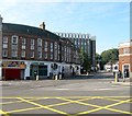
New England Road, Brighton
The A270 viewed from Preston Circus. Named after a former farm located on the western side of the railway it also formed the ancient parish boundary between Brighton and Preston until the latter was absorbed into the borough in 1928. By that time the road was the main A27 which it would remain until 1991 when the Brighton Bypass was opened. The building on the left containing Lloyds Bank was built in the early 1930s whilst beyond is Vantage Point added in the 1960s.
Image: © Simon Carey Taken: 11 Oct 2015
0.02 miles
6
New England Road
Campbell Road heads off to the right towards the London Road Viaduct. Beyond to the left is the junction with Argyle Road.
Image: © Simon Carey Taken: 25 Nov 2009
0.02 miles
7
Vantage Point
Image: © N Chadwick Taken: 3 Jul 2015
0.02 miles
8
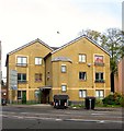
Amber Court, New England Road, Brighton
Flats built in the late 1990s on the former site of St Saviour's Mission Church which had opened in 1876 as the Christ Church Independent Chapel.
Image: © Simon Carey Taken: 25 Oct 2015
0.02 miles
9
New England Road, BN1 (2)
Image: © Mike Quinn Taken: 25 Jun 2014
0.02 miles
10
New England Road, BN1
Image: © Mike Quinn Taken: 25 Jun 2014
0.02 miles
  • ...