IMAGES TAKEN NEAR TO
Church Street, BRIGHTON, BN1 1RB

Introduction

This page details the photographs taken nearby to Church Street, BN1 1RB by members of the Geograph project.

The Geograph project started in 2005 with the aim of publishing, organising and preserving representative images for every square kilometre of Great Britain, Ireland and the Isle of Man.

There are currently over 7.5m images from over14,400 individuals and you can help contribute to the project by visiting https://www.geograph.org.uk

Image Map


Images are licensed for reuse under creativecommons.org/licenses/by-sa/2.0
Notes
  • Clicking on the map will re-center to the selected point.
  • The higher the marker number, the further away the image location is from the centre of the postcode.

Image Listing (1749 Images Found)

Images are licensed for reuse under creativecommons.org/licenses/by-sa/2.0
  • ...
Image
Details
Distance
1
King Street, BN1
Well, what's left of it.
Image: © Mike Quinn Taken: 8 May 2012
0.00 miles
2
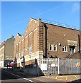
Electricity Company Depot, Church Street, Brighton
A remnant of the Victorian power station set up in North Road in 1890 until transferred to a much bigger premises at Southwick in 1906. Parts of the premises are still used as a sub station and some of the Victorian buildings have survived.
Image: © Simon Carey Taken: 1 Nov 2015
0.02 miles
3
Church Street
Image: © Oast House Archive Taken: 16 Oct 2010
0.02 miles
4
King Street Way
The name given to the footpath that runs alongside a multi-storey car park linking Image to Image the two remaining sections of the original King Street.
Image: © Simon Carey Taken: 19 Nov 2011
0.02 miles
5
King Street
Head south down Spring Gardens then east down Church Street until you reach King Street or what is left of it. The street once ran down to North Street but has been split into two distinct parts by the building of a multistorey car park in 1977 which destroyed a small street that had been built up from 1789 onwards. Only these cottages on the western side now survive. Click on the link to take you to the next page. http://www.geograph.org.uk/photo/230658
Image: © Simon Carey Taken: 1 Sep 2006
0.02 miles
6
Portland Street, BN1
Image: © Mike Quinn Taken: 8 May 2012
0.03 miles
7
Portland Street
A side street linking North Street to Church Street that was developed in the 1780s though only one cottage remains from that period at the northern end of the street, much of the rest came down in the 1960s and was redeveloped.
Image: © Simon Carey Taken: 19 Nov 2011
0.03 miles
8
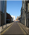
Church Street
Originally a path between the laines, the name given to small strips of fields that lay to the north of the original town of Brighton, known as North Back Side. It was given its current name in 1792 and climbs the hill from Old Steine to St Nicholas' church. Taken from the junction with Windsor Street the building on the left is the former drill hall built in 1889 for the Royal Sussex Regiment but now part of the Royal Mail sorting offices. Beyond is the junction with Spring Gardens.
Image: © Simon Carey Taken: 20 Jul 2009
0.04 miles
9
Spring Gardens
A side street linking Church Street to North Road. Originally built in the early 19th century and taking its name from Spring Walk, the original name of Church Street. Much of the eastern side was lost to the expansion of the electricity works in Bread Street of which a generating station still remains. The western side has lost all its original buildings with the large office building on the left, which includes a multi storey car park, built on the site of a former theatre. The building at the end of the street is Brighton's main sorting office constructed in the 1920s on the site of the former Regent Iron Foundry. For a view taken in 1962 see http://regencysociety-jamesgray.com/volume25/source/jg_25_133.html
Image: © Simon Carey Taken: 31 Jul 2011
0.04 miles
10
Brighton Place, The Lanes
Image: © Rob Purvis Taken: 5 Jul 2010
0.04 miles
  • ...