IMAGES TAKEN NEAR TO
Harper Green Road, BOLTON, BL4 7HT

Introduction

This page details the photographs taken nearby to Harper Green Road, BL4 7HT by members of the Geograph project.

The Geograph project started in 2005 with the aim of publishing, organising and preserving representative images for every square kilometre of Great Britain, Ireland and the Isle of Man.

There are currently over 7.5m images from over14,400 individuals and you can help contribute to the project by visiting https://www.geograph.org.uk

Image Map


Images are licensed for reuse under creativecommons.org/licenses/by-sa/2.0
Notes
  • Clicking on the map will re-center to the selected point.
  • The higher the marker number, the further away the image location is from the centre of the postcode.

Image Listing (10 Images Found)

Images are licensed for reuse under creativecommons.org/licenses/by-sa/2.0
Image
Details
Distance
1
Costcutter supermarket on Campbell Street
Image: © Bill Boaden Taken: 7 Sep 2015
0.06 miles
2
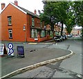
Campbell Street, Harper Green
Image: © Alex McGregor Taken: 13 Jun 2011
0.08 miles
3
A view of the reservoir
Image: © Ian Greig Taken: 20 Feb 2015
0.09 miles
4
A path alongside the reservoir
Protected by a locked gate
Image: © Ian Greig Taken: 20 Feb 2015
0.12 miles
5
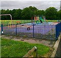
Play area off Cawdor Avenue, Harper Green
Image: © Alex McGregor Taken: 13 Jun 2011
0.13 miles
6
Bolton Cricket Club, Green Lane
Image: © David Dixon Taken: 5 Jun 2010
0.17 miles
7
The Pavilion, Bolton Cricket Club
Image: © David Dixon Taken: 5 Jun 2010
0.18 miles
8
A house with a nice view of the reservoir
Image: © Ian Greig Taken: 20 Feb 2015
0.19 miles
9
Harper Green Playing Fields
They have an open aspect with views across to Scout Moor.
Image: © Bill Boaden Taken: 7 Sep 2015
0.23 miles
10
Junction of Minerva Road and Bradford Road
This junction is one of the two main approaches for the Royal Bolton Hospital and as such sees a constant flow of traffic to and from the hospital.
Image: © John Tustin Taken: 9 Apr 2009
0.25 miles