IMAGES TAKEN NEAR TO
Upton Walk, BOLTON, BL3 6UJ

Introduction

This page details the photographs taken nearby to Upton Walk, BL3 6UJ by members of the Geograph project.

The Geograph project started in 2005 with the aim of publishing, organising and preserving representative images for every square kilometre of Great Britain, Ireland and the Isle of Man.

There are currently over 7.5m images from over14,400 individuals and you can help contribute to the project by visiting https://www.geograph.org.uk

Image Map


Images are licensed for reuse under creativecommons.org/licenses/by-sa/2.0
Notes
  • Clicking on the map will re-center to the selected point.
  • The higher the marker number, the further away the image location is from the centre of the postcode.

Image Listing (25 Images Found)

Images are licensed for reuse under creativecommons.org/licenses/by-sa/2.0
  • ...
Image
Details
Distance
1
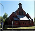
The Polish RC Church of the Good Shepherd
Image: © Bill Boaden Taken: 22 Sep 2012
0.09 miles
2
Peabody Street
Traditional cobbles and terraced housing.
Image: © Bill Boaden Taken: 22 Sep 2012
0.10 miles
3
Heywood Park
Image: © Robert Eva Taken: 17 Nov 2017
0.12 miles
4
Heywood Park, Bolton
Given by and named after Robert Heywood, a former local philanthropist and Mayor of Bolton in the early Victorian era.
Image: © Bill Boaden Taken: 22 Sep 2012
0.13 miles
5
Walking and cycle route 55 near Lever St, Bolton
Image: © Robert Eva Taken: 17 Nov 2017
0.14 miles
6
St Philip's Avenue
Looking towards the Swan Lane Mills complex. The houses appear to have been built at more or less the same time as the No.3 Mill seen here.
Image: © Alan Murray-Rust Taken: 21 Aug 2012
0.19 miles
7
St. Philip's Church
Church of England church on Bridgeman Street.
Image: © philandju Taken: 29 Jun 2018
0.20 miles
8
St. Philip's parish church, Bolton-le-Moors
Early 20th century church, started 1909 and consecrated 1911 http://www.geograph.org.uk/photo/3106919 Built in red brick with pale buff terracotta dressings. The church still refers to the full traditional name of the town.
Image: © Alan Murray-Rust Taken: 21 Aug 2012
0.21 miles
9
Foundation stone, St Philip's Church
The near face commemorates the laying of the stone on August 21st 1909 and the left hand side the consecration on January 25th 1911. http://www.geograph.org.uk/photo/3106906 for a view of the church.
Image: © Alan Murray-Rust Taken: 21 Aug 2012
0.21 miles
10
Bench mark, St Philip's Church
This is a pivot mark on the stone coping of the church railings. http://www.geograph.org.uk/photo/3106906
Image: © Alan Murray-Rust Taken: 21 Aug 2012
0.22 miles
  • ...