IMAGES TAKEN NEAR TO
Myrtle Place, SHIPLEY, BD18 4NB

Introduction

This page details the photographs taken nearby to Myrtle Place, BD18 4NB by members of the Geograph project.

The Geograph project started in 2005 with the aim of publishing, organising and preserving representative images for every square kilometre of Great Britain, Ireland and the Isle of Man.

There are currently over 7.5m images from over14,400 individuals and you can help contribute to the project by visiting https://www.geograph.org.uk

Image Map


Images are licensed for reuse under creativecommons.org/licenses/by-sa/2.0
Notes
  • Clicking on the map will re-center to the selected point.
  • The higher the marker number, the further away the image location is from the centre of the postcode.

Image Listing (611 Images Found)

Images are licensed for reuse under creativecommons.org/licenses/by-sa/2.0
  • ...
Image
Details
Distance
1
Katherine st
Grade II listed houses.
Image: © N Chadwick Taken: 5 May 2019
0.01 miles
2
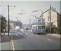
Bradford Trolleybus at Saltaire Terminus
Karrier W trolleybus 777 (CBX 600) at the terminus of the A657 Saltaire Road, waiting to depart on Route 40 to Bradford City Centre via Thackley and Five Lane Ends. This vehicle originally saw service in 1945 with Llanelly & District Traction Co (later South Wales Transport), but entered service in Bradford in early 1956, having been rebodied by East Lancs as a 63-seater. It was withdrawn on 30th June, 1971 when route 40 was converted to motorbus operation, nearly two months after this photo was taken.
Image: © David Hillas Taken: 4 May 1971
0.02 miles
3
Bradford trolleybus 789 passing Dove Street, Saltaire ? 1971
In the background on Dove Street is a row of the cottages built for workers at the adjacent Salt's Mill, now a World Heritage Centre site. The special trolleybus overhead wiring at this location was an emergency terminal point for use if the roundabout at the junction of Bingley Road and Saltaire Road was blocked by traffic; trolleybuses could reverse off Saltaire Road into Dove Street. Trolleybus 789 is one of 9 Karrier W vehicles of 1944 purchased from Darlington Corporation when its trolleybus system was closed. Bradford replaced the original single deck bodies with new double deck bodies before they entered service in 1959. This is one of a series of views featuring buses in the 60s, 70s, and 80s. http://www.geograph.org.uk/search.php?i=2114547&displayclass=slide
Image: © Alan Murray-Rust Taken: 30 Jun 1971
0.02 miles
4
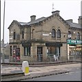
Former Lloyds Bank
Grade II listed. https://historicengland.org.uk/listing/the-list/list-entry/1314184
Image: © N Chadwick Taken: 5 May 2019
0.02 miles
5
Jane St
Grade II listed. https://historicengland.org.uk/listing/the-list/list-entry/1133580
Image: © N Chadwick Taken: 5 May 2019
0.02 miles
6
Dove St
Grade II listed. https://historicengland.org.uk/listing/the-list/list-entry/1199917
Image: © N Chadwick Taken: 5 May 2019
0.02 miles
7
Gourmet Corner - Bradford Road
Image: © Betty Longbottom Taken: 19 Jan 2010
0.02 miles
8
Dove St
Grade II listed houses.
Image: © N Chadwick Taken: 5 May 2019
0.02 miles
9
Cotson Reddish Insurance Brokers, Saltaire Road, Saltaire
Also an agency for the Bradford & Bingley.
Image: © Stephen Armstrong Taken: 25 Dec 2009
0.02 miles
10
Benchmark on #3 Albert Road
Ordnance Survey cut mark benchmark described on the Bench Mark Database at http://www.bench-marks.org.uk/bm69115
Image: © Roger Templeman Taken: 16 Jun 2015
0.02 miles
  • ...