IMAGES TAKEN NEAR TO
Simes Street, BRADFORD, BD1 3RB

Introduction

This page details the photographs taken nearby to Simes Street, BD1 3RB by members of the Geograph project.

The Geograph project started in 2005 with the aim of publishing, organising and preserving representative images for every square kilometre of Great Britain, Ireland and the Isle of Man.

There are currently over 7.5m images from over14,400 individuals and you can help contribute to the project by visiting https://www.geograph.org.uk

Image Map


Images are licensed for reuse under creativecommons.org/licenses/by-sa/2.0
Notes
  • Clicking on the map will re-center to the selected point.
  • The higher the marker number, the further away the image location is from the centre of the postcode.

Image Listing (703 Images Found)

Images are licensed for reuse under creativecommons.org/licenses/by-sa/2.0
  • ...
Image
Details
Distance
1
Rawson Market - Infirmary Street
Now dis-used.
Image: © Betty Longbottom Taken: 25 Nov 2007
0.00 miles
2
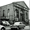
Former St Andrew's Presbyterian Chapel, Westgate, Bradford
Plain rubble box distinguished by ashlar west front which has an attached Doric portico complete with pediment. The semi-circular window above the door resembles a Georgian fanlight. By Mallinson & Healey, 1849. Grade II listed. Used by the Little Monsters kindergarten, but possibly not much else.
Image: © Stephen Richards Taken: 14 Jun 2012
0.01 miles
3
The old St. Andrew's Presbyterian Church
Image: © habiloid Taken: 5 Aug 2011
0.01 miles
4
Bradford, St. Andrew's Presbyterian Church
This was later converted into an Asian Restaurant
Image: © Alan Longbottom Taken: Unknown
0.02 miles
5
Former Presbyterian church, Bradford
The church, originally known as St Andrew's Presbyterian church and later as a United Reformed Church, was built in 1849. The reason for it now being set a long way back from the road is that it was built on Infirmary Street, which like the infirmary itself no longer exists. I haven't found the date of closure but it has had a variety of uses since closure including as an Asian restaurant and later a kindergarten Image but looks to be vacant at present. Listed grade II (list entry 1133066).
Image: © Stephen Craven Taken: 26 Mar 2022
0.02 miles
6
Westgate Chapel
Built as St Andrew's Presbyterian Chapel it then became an Asian Restaurant. Part is now occupied by a Kindergarten.
Image: © Betty Longbottom Taken: 21 Apr 2007
0.02 miles
7
Does this reflect a changing religious balance of power?
The church in the foreground was originally St Andrews Presbyterian Church Image with a substantial Scottish congregation, but it is no longer in use. (Thanks to Rich Tea for information.) Meanwhile there is an apparently wealthy new mosque behind it.
Image: © Bill Boaden Taken: 20 Nov 2009
0.03 miles
8
Shaw Moisture Meters - Westgate
Image: © Betty Longbottom Taken: 25 Oct 2009
0.04 miles
9
Bradford, Drewton Street
Now demolished
Image: © Alan Longbottom Taken: Unknown
0.04 miles
10
Bradford, Drewton Street
Now demolished
Image: © Alan Longbottom Taken: Unknown
0.04 miles
  • ...