1
Sunday lunchtime at the Longs Arms, Steeple Ashton
Image: © David Martin
Taken: 30 Sep 2018
0.04 miles
2
Steeple Ashton houses [41]
Black Barn Cottage, number 46 High Street, is an open hall house, built in the 15th century, altered and improved in the 16th century and refronted in the early 19th century. The cottage was restored in the 20th century. Timber framed with square panels and brick noggin on a stone plinth under a stone slate roof. The front is rendered. Inside, the hall has a 16th century inserted ceiling. Many original internal features and fittings remain. Listed, grade II*, with details at: https://historicengland.org.uk/listing/the-list/list-entry/1262168
The village of Steeple Ashton is a former market town, having been granted a weekly market in 1266. It lies some 3¼ miles east of Trowbridge and some 7 miles southwest of Devizes. The town became wealthy from its cloth industry, but there was a great fire in the early 16th century, and when it came to rebuilding the industry moved to the nearby town of Trowbridge, where the River Biss provided power for fulling mills. The first part of the village name comes from the former church spire, which collapsed in 1670.
Image: © Michael Dibb
Taken: 14 Feb 2023
0.04 miles
3
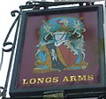
Sign at the Longs Arms PH
Image: © Shazz
Taken: 22 Apr 2013
0.04 miles
4
Steeple Ashton buildings [6]
This barn is at number 46 High Street on the corner with Acreshort Lane. Built in the 16th century, it is timber framed on a rubble stone plinth with weatherboard cladding under a stone slate roof. There are five bays plus an added stable bay, possible 17th century, at the west end. Listed, grade II, with details at: https://historicengland.org.uk/listing/the-list/list-entry/1252685
The village of Steeple Ashton is a former market town, having been granted a weekly market in 1266. It lies some 3¼ miles east of Trowbridge and some 7 miles southwest of Devizes. The town became wealthy from its cloth industry, but there was a great fire in the early 16th century, and when it came to rebuilding the industry moved to the nearby town of Trowbridge, where the River Biss provided power for fulling mills. The first part of the village name comes from the former church spire, which collapsed in 1670.
Image: © Michael Dibb
Taken: 14 Feb 2023
0.05 miles
5
Steeple Ashton buildings [5]
The Longs Arms, number 44 High Street, was built circa 1700 and extended in the late 19th century with a single-storey addition projecting to the front. Constructed of limestone ashlar under a stone slate roof. Some 19th century internal features and fittings remain. The public house takes its name from the Long family of Rood Ashton who owned much of the village until the mid 20th century. Listed, grade II, with details at: https://historicengland.org.uk/listing/the-list/list-entry/1252684
The village of Steeple Ashton is a former market town, having been granted a weekly market in 1266. It lies some 3¼ miles east of Trowbridge and some 7 miles southwest of Devizes. The town became wealthy from its cloth industry, but there was a great fire in the early 16th century, and when it came to rebuilding the industry moved to the nearby town of Trowbridge, where the River Biss provided power for fulling mills. The first part of the village name comes from the former church spire, which collapsed in 1670.
Image: © Michael Dibb
Taken: 14 Feb 2023
0.05 miles
6
The Smithy, Steeple Ashton
The old Smithy, now disused, lies up a lane on the west side of the High Street
Image: © Paul Taylor
Taken: 7 Jul 2007
0.05 miles
7
Steeple Ashton houses [42]
The Old Shop, number 48 High Street, is a 15th century hall house, altered in the 16th century with the addition of a cross wing and altered again in the late 19th century. Timber framed with square panels and brick nogging on a dressed stone plinth and jettied to the street. The ground floor has been partly rebuilt in brick, the roof is of stone slate. The 20th century shopfront has been removed. The former hall has a 16th century inserted ceiling and some original features remain. Listed, grade II, with details at: https://historicengland.org.uk/listing/the-list/list-entry/1262131
The village of Steeple Ashton is a former market town, having been granted a weekly market in 1266. It lies some 3¼ miles east of Trowbridge and some 7 miles southwest of Devizes. The town became wealthy from its cloth industry, but there was a great fire in the early 16th century, and when it came to rebuilding the industry moved to the nearby town of Trowbridge, where the River Biss provided power for fulling mills. The first part of the village name comes from the former church spire, which collapsed in 1670.
Image: © Michael Dibb
Taken: 14 Feb 2023
0.05 miles
8
The Long Arms, Steeple Ashton
The inn was built in the early 1700 and extended in the mid 19th century. It boasts a high position in the top 25 pubs in Wiltshire.
Image: © Maigheach-gheal
Taken: 27 Jul 2009
0.06 miles
9
Old Merchants Hall, Steeple Ashton
On the west side of the High Street. The plaque above the door gives the name as the Old Merchants Hall. The building is now a residence built in the mid 16th century.
Image: © Maigheach-gheal
Taken: 27 Jul 2009
0.06 miles
10
High Street, Steeple Ashton ca 1980 (2)
Image: © Ronald Searle
Taken: Unknown
0.06 miles


![Steeple Ashton houses [41]](https://s2.geograph.org.uk/geophotos/07/43/66/7436626_99ab2c9f_120x120.jpg)

![Steeple Ashton buildings [6]](https://s2.geograph.org.uk/geophotos/07/43/66/7436630_56ab5543_120x120.jpg)
![Steeple Ashton buildings [5]](https://s2.geograph.org.uk/geophotos/07/43/58/7435882_7c95c8a6_120x120.jpg)

![Steeple Ashton houses [42]](https://s3.geograph.org.uk/geophotos/07/43/66/7436635_0ce7597c_120x120.jpg)


