1
Trompe L'oeil, Roundstone Street
This may possibly be the largest trompe l'oeil in the country, and was installed on the blank wall of this building in Roundstone Street in October 2003 to commemorate the 25th anniversary of Trowbridge civic society. Work was carried out by artist Roger Smith and Wiltshire Steeplejacks.
Image: © Phil Williams
Taken: 27 Feb 2006
0.01 miles
2
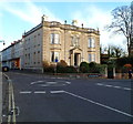
The Polebarn Hotel, Trowbridge
On the corner of Polebarn Road and Roundstone Street, viewed from Church Street.
Built as Polebarn House, was first occupied in 1789 by John Clark, a local mill owner, and his family. The house, one of the few built with Bath Stone in Trowbridge, was designed as a display of his wealth and status. Last used as a private residence in 1920, it then had varying uses, such as offices and flats.
It was renamed The Polebarn Hotel in 1978.
Image: © Jaggery
Taken: 5 Dec 2011
0.01 miles
3
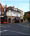
The Carpenters Arms, Trowbridge
Pub at 26 Roundstone Street, opposite the Polebarn Hotel. http://www.geograph.org.uk/photo/2739599
The car is parked is a lane named Carpenters Arms Yard.
Image: © Jaggery
Taken: 5 Dec 2011
0.01 miles
4
Silver Street
Image: © Oast House Archive
Taken: 24 Aug 2013
0.03 miles
5
The Black Pearl
One of Trowbridge's more colourful pubs, it is currently in trouble. A licensing application has been rejected from a prospective landlord, taking over from the previous. However, after some concern over the conduct and reputation here the councillors have turned it down. The pub has been closed for about a month but the bills have not stopped - doubts hang over the place now.
Image: © Neil Owen
Taken: 24 Sep 2014
0.03 miles
6
The White Swan
Take it as read - the pub is called the White Swan, despite the crossword-like incompletion. Interestingly enough, it is right next door to the Black Pearl, but appears to be able to offer some live music as an alternative. The skull and crossbones is actually a birthday greeting
Image: © Neil Owen
Taken: 24 Sep 2014
0.04 miles
7
Pitman House
This block of commercial buildings is thought to have been built in about 1795 and was originally the Samuel Pitman factory. Grade II listed since 1976.
Image: © Neil Owen
Taken: 24 Sep 2014
0.04 miles
8
Trowbridge buildings [8]
The White Swan public house, number 6 Church Street, was built in the late 17th or early 18th century. Constructed of rubble stone, the front rendered, under a double Roman tile roof. The pub has closed since the date of this image. Listed, grade II, with details at: https://historicengland.org.uk/listing/the-list/list-entry/1182648
A market town and county town of Wiltshire, Trowbridge lies on the River Biss, 6 miles (10 kilometres) south of Bath. The town developed as a centre for woollen cloth production from the 14th century, which from the 17th century became increasingly industrialized, so much so that, in 1820, Trowbridge was described as the "Manchester of the West" with over 20 woollen cloth producing factories. The Kennet and Avon Canal runs just to the north of the town and both the Wessex Main Line (Bristol–Westbury–Southampton) and the Heart of Wessex Line (Bristol–Westbury–Weymouth) railways serve the station.
Image: © Michael Dibb
Taken: 14 Feb 2023
0.05 miles
9
Roundstone Street, Trowbridge
Looking towards the Polebarn Hotel
Image: © David Smith
Taken: 8 Jun 2017
0.05 miles
10
Junction of Polebarn Road and Church Street, Trowbridge
As seen from the first floor of The Polebarn Hotel.
See http://www.geograph.org.uk/photo/4720691 for an internal view of the window I took this from.
For a reciprocal view of the hotel see http://www.geograph.org.uk/photo/3624585.
Image: © Penny Mayes
Taken: 17 Oct 2015
0.05 miles


![Trowbridge buildings [8]](https://s3.geograph.org.uk/geophotos/07/43/74/7437431_3eb6a65c_120x120.jpg)

