1
St Peters Church, Hall Green
In 1923 following the growth of population in the area, and a generous gift of land from Colonel Jervaise, a small wooden building was erected and opened as a chapel (in September 1923) dedicated to St. Cadoc.
Continued growth in numbers over the next 30 years eventually saw this building re-dedicated in 1954 to St. Peter and the appointment of the first resident priest, Fr. Joseph Adlam. Some 5 years later plans were made for a more permanent building when on April 18th 1959 tragedy struck. A fire engulfed the wooden church, that had served for so long, and plans for expansion lay in ashes.
Using firstly a small wooden hut and later, the newly built parish hall, services were to continue for over four years before the completion of our wonderful new building.
The foundation stone was laid on July 14th 1962 and building eventually completed for the official opening in 1964. Over the next two years life reverted to normal with the parish hall being used for social and group meetings rather than religious services. Father Adlam was unfortunately unable to enjoy the ‘fruits of his labours’ for very long. He died suddenly on November 4th 1966. At his funeral the Bishop of Aston, The Right Rev. David Porter, said ‘Your new church is the finest memorial that Joseph Adlam could possibly have. It epitomises all that he lived for, hoped for, and slaved for and, if ever a man could die happy in the knowledge of a task fulfilled, it was he.’
Image: © Darius Khan
Taken: 12 Oct 2001
0.05 miles
2
Bus stop on Highfield Road, Yardley Wood
Looking north east.
Image: © JThomas
Taken: 6 May 2017
0.08 miles
3
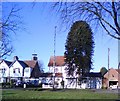
Highfield Road
Araucaria araucana
Image: © araucaria araucana
Taken: 20 Jan 2011
0.09 miles
4
Houses on Highfield Road, Yardley Wood
Image: © JThomas
Taken: 6 May 2017
0.10 miles
5
Highfield Road, Hall Green
Image: © Darius Khan
Taken: 25 Sep 2001
0.11 miles
6
Highfield Road Yardley Wood
Image: © Roy Hughes
Taken: 10 Dec 2021
0.12 miles
7
Highfield Road, Yardley Wood
Looking north east.
Image: © JThomas
Taken: 6 May 2017
0.12 miles
8
Highfield Road at Webb Lane, Yardley Wood
Image: © Roy Hughes
Taken: 10 Dec 2021
0.12 miles
9
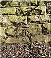
OS benchmark - Yardley Wood, wall on Highfield Road
An OS cutmark on the wall outside nos 276 & 278; originally levelled, probably in 1965, at 138.34m above Ordnance Datum Newlyn.
Image: © Richard Law
Taken: 18 Apr 2018
0.15 miles
10
Robin Hood Lane, Yardley Wood
Image: © Roy Hughes
Taken: 10 Dec 2021
0.16 miles


