IMAGES TAKEN NEAR TO
Rannes Street, INSCH, AB52 6JJ

Introduction

This page details the photographs taken nearby to Rannes Street, AB52 6JJ by members of the Geograph project.

The Geograph project started in 2005 with the aim of publishing, organising and preserving representative images for every square kilometre of Great Britain, Ireland and the Isle of Man.

There are currently over 7.5m images from over14,400 individuals and you can help contribute to the project by visiting https://www.geograph.org.uk

Image Map


Images are licensed for reuse under creativecommons.org/licenses/by-sa/2.0
Notes
  • Clicking on the map will re-center to the selected point.
  • The higher the marker number, the further away the image location is from the centre of the postcode.

Image Listing (32 Images Found)

Images are licensed for reuse under creativecommons.org/licenses/by-sa/2.0
  • ...
Image
Details
Distance
1
Insch primary school
The main block (pictured) was built in 1898 and extended several times. The school roll (2017-18) of 422 is huge by Aberdeenshire standards.
Image: © Bill Harrison Taken: 7 Jul 2018
0.05 miles
2
Insch cottage hospital
Built 1922 to serve as a memorial of the War.
Image: © Bill Harrison Taken: 7 Jul 2018
0.06 miles
3
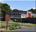
Insch fire station
Built on the site of the free kirk.
Image: © Bill Harrison Taken: 7 Jul 2018
0.07 miles
4
Public open space Insch
Image: © Bill Harrison Taken: 7 Jul 2018
0.07 miles
5
View of the Shevock
The burn that runs through Insch has the unusual name of the Shevock and joins the River Urie a few km to the east. A footbridge now crosses it to access new housing developments to the south of the burn. According to Celtic Placenames in Aberdeenshire by John Milne, 'shevock' means 'placid little burn'.
Image: © Bill Harrison Taken: 7 Jul 2018
0.09 miles
6
Insch community centre
Built 1869 and formerly the public hall.
Image: © Bill Harrison Taken: 7 Jul 2018
0.10 miles
7
Bridge over the burn
Image: © Bill Harrison Taken: 7 Jul 2018
0.10 miles
8
Radulfus stone, Insch
The grave-slab was found buried in the kirkyard in the 19th Century. The very worn inscription to Radulfus, a 12th Century priest, can just be discerned. For more, see Epitaphs and Inscriptions from Burial Grounds and Old Buildings... by Alexander Jervise, vol. 1. p. 20 (available as a free download from archive.org).
Image: © Bill Harrison Taken: 7 Jul 2018
0.11 miles
9
Insch library and institute
1928 on the date-stone.
Image: © Bill Harrison Taken: 7 Jul 2018
0.11 miles
10
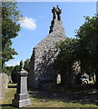
Insch old kirk
Only the gable end and bellcote remain of the kirk remain, probably built in 1769. The fine renaissance bellcote (dated 1613) must come from an earlier church on the same site. The kirk fell into ruin after the replacement church on Western Road was built in 1883. C-listed (LB9065): http://portal.historicenvironment.scot/designation/LB9065 .
Image: © Bill Harrison Taken: 7 Jul 2018
0.12 miles
  • ...