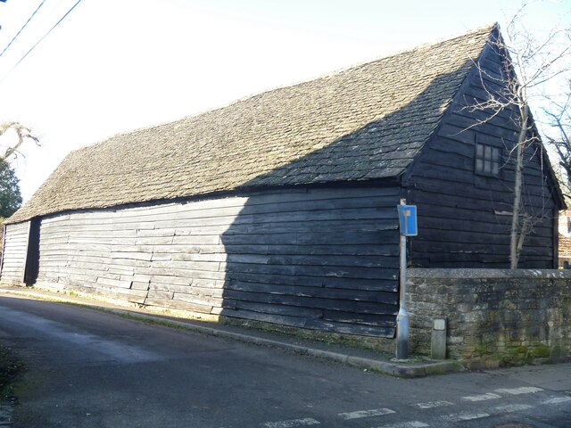
Steeple Ashton buildings [6]
Introduction
The photograph on this page of Steeple Ashton buildings [6] by Michael Dibb as part of the Geograph project.
The Geograph project started in 2005 with the aim of publishing, organising and preserving representative images for every square kilometre of Great Britain, Ireland and the Isle of Man.
There are currently over 7.5m images from over 14,400 individuals and you can help contribute to the project by visiting https://www.geograph.org.uk

Image: © Michael Dibb Taken: 14 Feb 2023
This barn is at number 46 High Street on the corner with Acreshort Lane. Built in the 16th century, it is timber framed on a rubble stone plinth with weatherboard cladding under a stone slate roof. There are five bays plus an added stable bay, possible 17th century, at the west end. Listed, grade II, with details at: https://historicengland.org.uk/listing/the-list/list-entry/1252685 The village of Steeple Ashton is a former market town, having been granted a weekly market in 1266. It lies some 3¼ miles east of Trowbridge and some 7 miles southwest of Devizes. The town became wealthy from its cloth industry, but there was a great fire in the early 16th century, and when it came to rebuilding the industry moved to the nearby town of Trowbridge, where the River Biss provided power for fulling mills. The first part of the village name comes from the former church spire, which collapsed in 1670.

