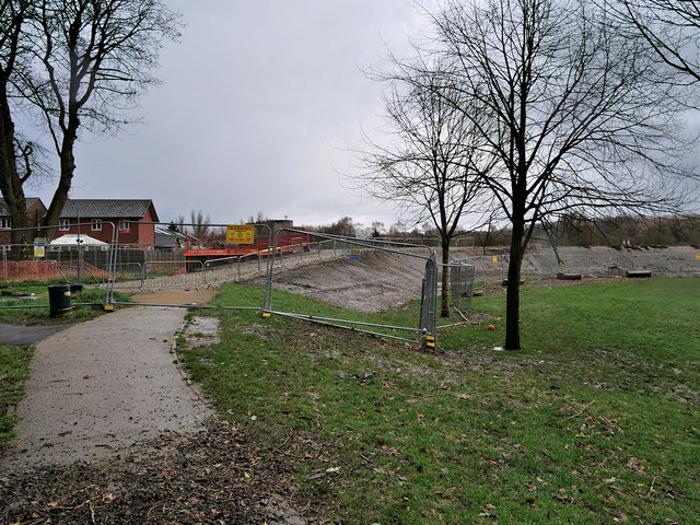
Construction of Flood Defences at Close Park
Introduction
The photograph on this page of Construction of Flood Defences at Close Park by David Dixon as part of the Geograph project.
The Geograph project started in 2005 with the aim of publishing, organising and preserving representative images for every square kilometre of Great Britain, Ireland and the Isle of Man.
There are currently over 7.5m images from over 14,400 individuals and you can help contribute to the project by visiting https://www.geograph.org.uk

Image: © David Dixon Taken: 11 Feb 2020
Construction of the first phase of a major £40million flood defence scheme in Close Park began in June 2019. The scheme is designed to protect up to 873 homes in the Redvales area from a repeat of that catastrophic flooding which occurred on Boxing Day 2015 https://www.geograph.org.uk/search.php?i=110097617&displayclass=black . The work involves the building of a 2½ metre flood wall at the rear of houses in Parkside Close, and a 3 metre-high earth embankment on the far side of the park. This embankment will integrate a footpath and landscaping 'to soften' the overall appearance. The football pitches will continue to act as a floodplain.

