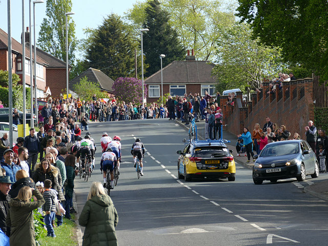
What road closure? (1)
Introduction
The photograph on this page of What road closure? (1) by Stephen Craven as part of the Geograph project.
The Geograph project started in 2005 with the aim of publishing, organising and preserving representative images for every square kilometre of Great Britain, Ireland and the Isle of Man.
There are currently over 7.5m images from over 14,400 individuals and you can help contribute to the project by visiting https://www.geograph.org.uk

Image: © Stephen Craven Taken: 5 May 2019
The traffic management of the 2019 Tour de Yorkshire, as it passed through west Leeds, left much to be desired. Notices had been up for weeks warning of road closures, but there were no barriers and few police or other marshals, and several drivers defied the closure. Here, the yellow car belonging to one of the race teams was being used as a shield to keep the other car (which had been coming down the 'closed' road) away from the racers.

