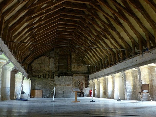
Blackfriars, Gloucester, south range
Introduction
The photograph on this page of Blackfriars, Gloucester, south range by Alan Murray-Rust as part of the Geograph project.
The Geograph project started in 2005 with the aim of publishing, organising and preserving representative images for every square kilometre of Great Britain, Ireland and the Isle of Man.
There are currently over 7.5m images from over 14,400 individuals and you can help contribute to the project by visiting https://www.geograph.org.uk

Image: © Alan Murray-Rust Taken: 15 Apr 2019
Scriptorium and library on the upper floor. The roof is the original mid 13th century structure. At the side of the space are a series of carrels with short separating walls providing places for study and writing. The building was converted after the Dissolution to a cloth manufactory, with further later conversions. Listed Grade I. Blackfriars is an English Heritage property, managed by Gloucester City Council as a function venue.

