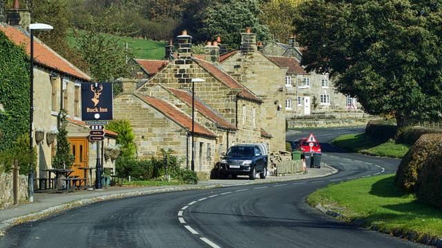
Chop Gate
Introduction
The photograph on this page of Chop Gate by Mick Garratt as part of the Geograph project.
The Geograph project started in 2005 with the aim of publishing, organising and preserving representative images for every square kilometre of Great Britain, Ireland and the Isle of Man.
There are currently over 7.5m images from over 14,400 individuals and you can help contribute to the project by visiting https://www.geograph.org.uk

Image: © Mick Garratt Taken: 10 Oct 2018
Woe betides anyone who pronounces this village with a hard ‘g’, in the same way as your garden gate. As every Yorkshireman will tell you it’s Chop Yat which is a mix of etymological roots. The Yat is Old Norse for a road and Chop comes from the Old English ‘ceap‘ for an itinerant peddler. Several medieval trading routes across the surrounding moors converge on the village, so maybe at one time, there may have been a thriving trading post here. Today the route is on the notorious B1257 between Stokesley and Helmsley, very popular with motorcyclists but with many accidents over the years. One leading motorbike magazine referred to it as the North Yorkshire TT. A peddler’s route is but one explanation for the name of the village and like all things etymological someone else offers an alternative in that the name is, in fact, a derivation of Chapel Yate. Here the Yate means a tongue of land between two streams and implying a chapel of ease may have stood here. On the left is the Buck Inn, first mentioned in a 1781/2 survey as Bakers Coffie House. I thought the 18th-century coffee house culture was confined to the larger cities so it is a little strange that one was in business in a quiet dale in the North Riding of Yorkshire. By 1826 though it was listed as a public house. From my blog http://www.fhithich.uk/?p=20313

