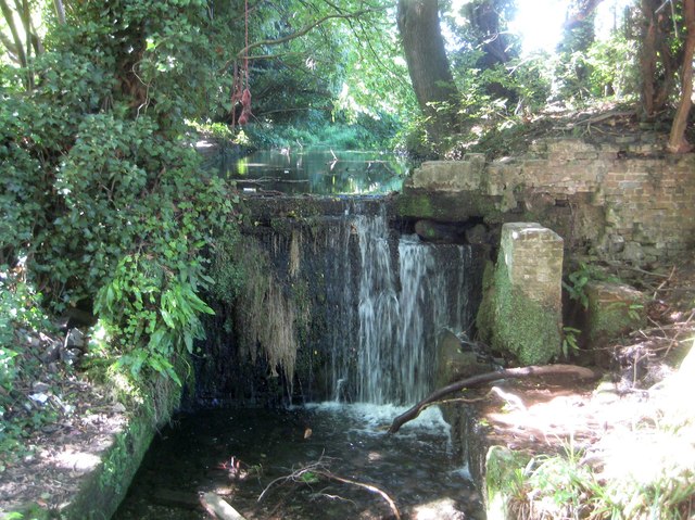
River Chess: Site of the former Cannon Mill
Introduction
The photograph on this page of River Chess: Site of the former Cannon Mill by Nigel Cox as part of the Geograph project.
The Geograph project started in 2005 with the aim of publishing, organising and preserving representative images for every square kilometre of Great Britain, Ireland and the Isle of Man.
There are currently over 7.5m images from over 14,400 individuals and you can help contribute to the project by visiting https://www.geograph.org.uk

Image: © Nigel Cox Taken: 13 Sep 2018
This weir and broken brickwork indicate the location of the former Cannon Mill, that is said to have been demolished in the 1960s. The flat body of water above the weir would have been the mill leat, and the water would have driven a mill wheel positioned in the brick recess below. There is a descriptive notice board nearby that describes it as Canon's Mill, but all the old Ordnance Survey mapping from 1878 onwards describes it as Cannon Mill, so the photographer has opted for the latter. Incidentally the pink item above the weir that looks like a suspended animal carcase is in fact a children's play swing...

