Temple Church
Introduction
The photograph on this page of Temple Church by Eirian Evans as part of the Geograph project.
The Geograph project started in 2005 with the aim of publishing, organising and preserving representative images for every square kilometre of Great Britain, Ireland and the Isle of Man.

There are currently over 7.5m images from over 14,400 individuals and you can help contribute to the project by visiting https://www.geograph.org.uk
Temple Church
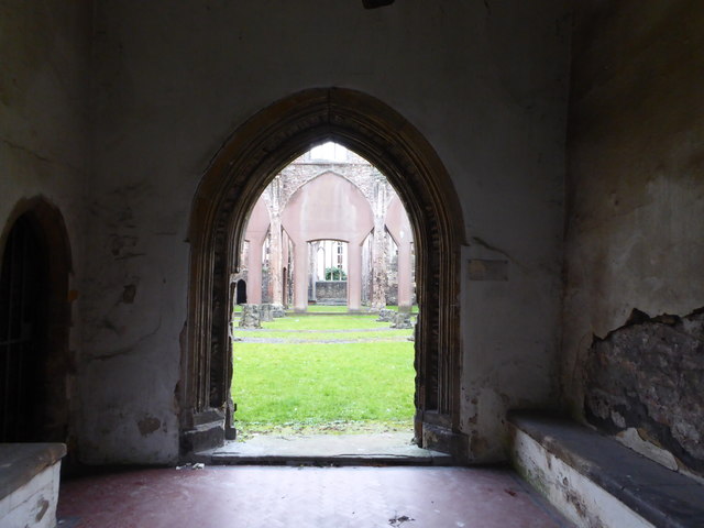
Image: © Eirian Evans Taken: 20 Feb 2018
Blitzed during the war, the church was not demolished - it was one of the largest and most important churches in Bristol partly due to the wealth of the weavers in this area. Temple was where cloth workers lived and worked in the medieval period.
Images are licensed for reuse under creativecommons.org/licenses/by-sa/2.0
Image Location


Leaflet Map data © OpenStreetMap
Latitude
51.452082
Longitude
-2.586821