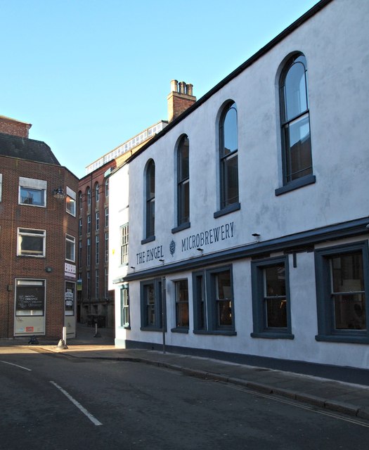
Stoney Street, Hockley, Nottingham 1
Introduction
The photograph on this page of Stoney Street, Hockley, Nottingham 1 by David Hallam-Jones as part of the Geograph project.
The Geograph project started in 2005 with the aim of publishing, organising and preserving representative images for every square kilometre of Great Britain, Ireland and the Isle of Man.
There are currently over 7.5m images from over 14,400 individuals and you can help contribute to the project by visiting https://www.geograph.org.uk

Image: © David Hallam-Jones Taken: 2 Jan 2017
A view of the Grade II-listed former "Old Angel Inn" at the junction of Woolpack Lane. This property was originally two houses that were converted into a public house c1800. The premises were altered again altered 1878 by Lawrence Bright of Nottingham for W Robinson and also in 1883 by H. Walker for J Robinson. They were finally restored and modernised in late C20th. Not only are there a series of caves beneath the pub that have been put to use in various over the years, but there was also a 'chapel' on the first floor - created in 1801 - as a meeting place for National Ancient Imperial Union of Odd Fellows. Later on the chapel was used by the Ancient Order of Druids and the Royal Antediluvian Order of Buffaloes. The top floor is said to have been used as a brothel in the past. The current manager has recently (2016-17) finished refurbishing the main bar area and the chapel and work on the top floor is on-going.

