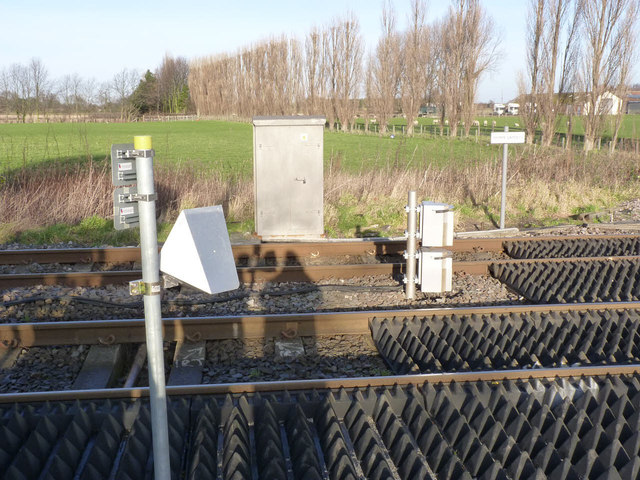
Obstacle detection equipment at Thorpe Gates level crossing
Introduction
The photograph on this page of Obstacle detection equipment at Thorpe Gates level crossing by Alan Murray-Rust as part of the Geograph project.
The Geograph project started in 2005 with the aim of publishing, organising and preserving representative images for every square kilometre of Great Britain, Ireland and the Isle of Man.
There are currently over 7.5m images from over 14,400 individuals and you can help contribute to the project by visiting https://www.geograph.org.uk

Image: © Alan Murray-Rust Taken: 25 Dec 2013
The crossing has recently been converted from manual operation to radar plus lidar obstacle detection to ensure the crossing is clear for rail movements. In this view the triangular object close to the camera is the radar, the two units one above the other on a short post are the lidar. Unfortunately the system is proving unreliable, and local manual control has had to be introduced on a temporary basis. This was not evident at the time of my visit - being Christmas Day, there were no trains running.

