Wimborne Minster: bunting in East Street
Introduction
The photograph on this page of Wimborne Minster: bunting in East Street by Chris Downer as part of the Geograph project.
The Geograph project started in 2005 with the aim of publishing, organising and preserving representative images for every square kilometre of Great Britain, Ireland and the Isle of Man.

There are currently over 7.5m images from over 14,400 individuals and you can help contribute to the project by visiting https://www.geograph.org.uk
Wimborne Minster: bunting in East Street
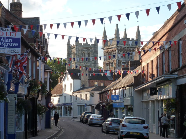
Image: © Chris Downer Taken: 6 Oct 2012
East Street, as its name suggests, was originally the main street heading east out of the town centre, although the needs of modern-day motoring means that it is not now encountered by through traffic. In fact, it is a one-way street heading towards the town centre, in the direction that we are looking here towards Clock Corner (see Image). The towers of the Minster loom large in the background.
Images are licensed for reuse under creativecommons.org/licenses/by-sa/2.0
Image Location


Leaflet Map data © OpenStreetMap
Latitude
50.798481
Longitude
-1.986752