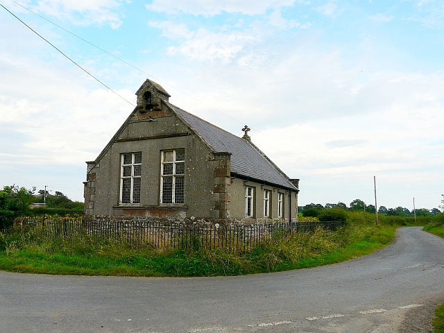
Former chapel, Dundraw
Introduction
The photograph on this page of Former chapel, Dundraw by Rose and Trev Clough as part of the Geograph project.
The Geograph project started in 2005 with the aim of publishing, organising and preserving representative images for every square kilometre of Great Britain, Ireland and the Isle of Man.
There are currently over 7.5m images from over 14,400 individuals and you can help contribute to the project by visiting https://www.geograph.org.uk

Image: © Rose and Trev Clough Taken: 12 Aug 2012
We could not find a definitive name for this building, which appears to be currently unused. An article by the local Women's Institute http://www.visitoruk.com/historydetail.php?id=27114&cid=592&f=Carlisle refers to it as a mission room, built in 1901. It is marked on old maps http://www.old-maps.co.uk/maps.html?txtXCoord=321522&txtYCoord=549700 as 'Church Room'. Dundraw also had a Mission Hall, a short distance from here on the Waverbridge road. That has a datestone of 1896, and has been converted to a house (Google Street View http://maps.google.co.uk/maps?q=dundraw&hl=en&ll=54.835166,-3.219498&spn=0.000822,0.005466&sll=52.8382,-2.327815&sspn=7.767092,22.456055&hnear=Dundraw,+Cumbria,+United+Kingdom&t=h&z=18&layer=c&cbll=54.835166,-3.220522&panoid=N2rExQ5li-DKWSON57EcWA&cbp=12,148.78,,0,-3.8 ).

