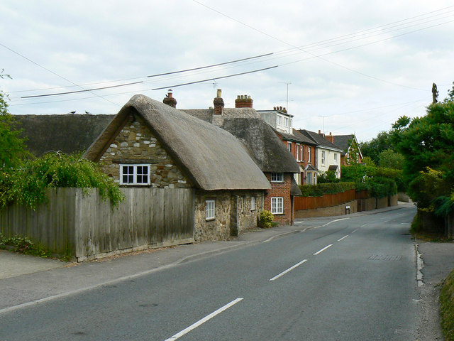
27 Turnball, Chiseldon (1)
Introduction
The photograph on this page of 27 Turnball, Chiseldon (1) by Brian Robert Marshall as part of the Geograph project.
The Geograph project started in 2005 with the aim of publishing, organising and preserving representative images for every square kilometre of Great Britain, Ireland and the Isle of Man.
There are currently over 7.5m images from over 14,400 individuals and you can help contribute to the project by visiting https://www.geograph.org.uk

Image: © Brian Robert Marshall Taken: 30 Jun 2010
The building was once a toll house. It is listed Grade II http://www.imagesofengland.org.uk/Details/default.aspx?pid=2&id=318335 I am grateful to a fellow contributor for the following additional information: 'Swindon and Hungerford Road turnpiked between 1815-1874 The original terrace of stone cottages under a thatched roof is late 17th century. A further cottage seems to have been added in the 18th century. Finally the red brick section, angled to Hodson road was added in the early 19th century to form the toll house. The turnpike room has a flagstone floor and low ceiling.' Hodson Road is in the foreground.

