Stifford's Bridge
Introduction
The photograph on this page of Stifford's Bridge by Philip Halling as part of the Geograph project.
The Geograph project started in 2005 with the aim of publishing, organising and preserving representative images for every square kilometre of Great Britain, Ireland and the Isle of Man.

There are currently over 7.5m images from over 14,400 individuals and you can help contribute to the project by visiting https://www.geograph.org.uk
Stifford's Bridge
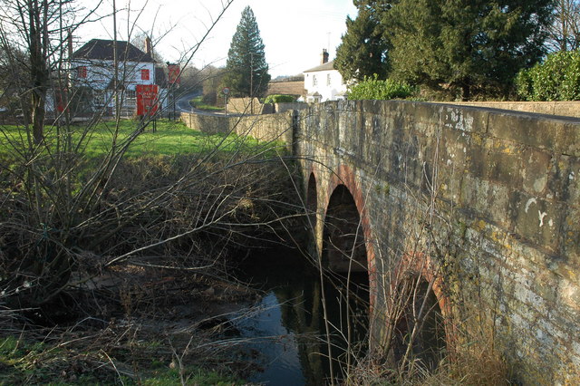
Image: © Philip Halling Taken: 28 Dec 2008
Stifford's Bridge carries the A4103 over Cradley Brook, the Red Lion Inn can be seen in the background (unfortunately now closed).
Images are licensed for reuse under creativecommons.org/licenses/by-sa/2.0
Image Location


Leaflet Map data © OpenStreetMap
Latitude
52.130022
Longitude
-2.389125